⚠🧊❄Significant ice accumulations followed by snow⚠🧊❄
…Significant Ice Storm Tonight into Tuesday…
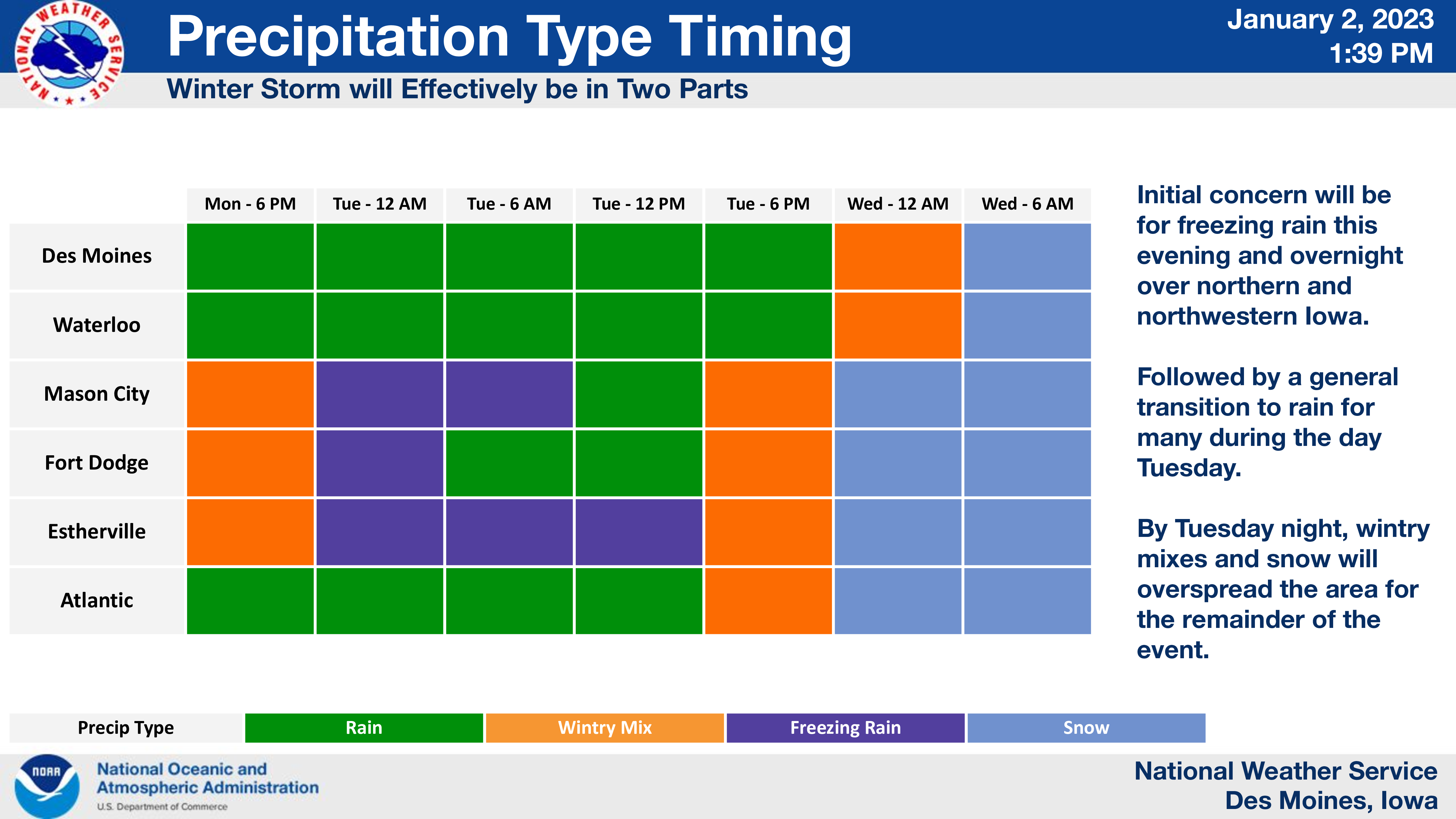
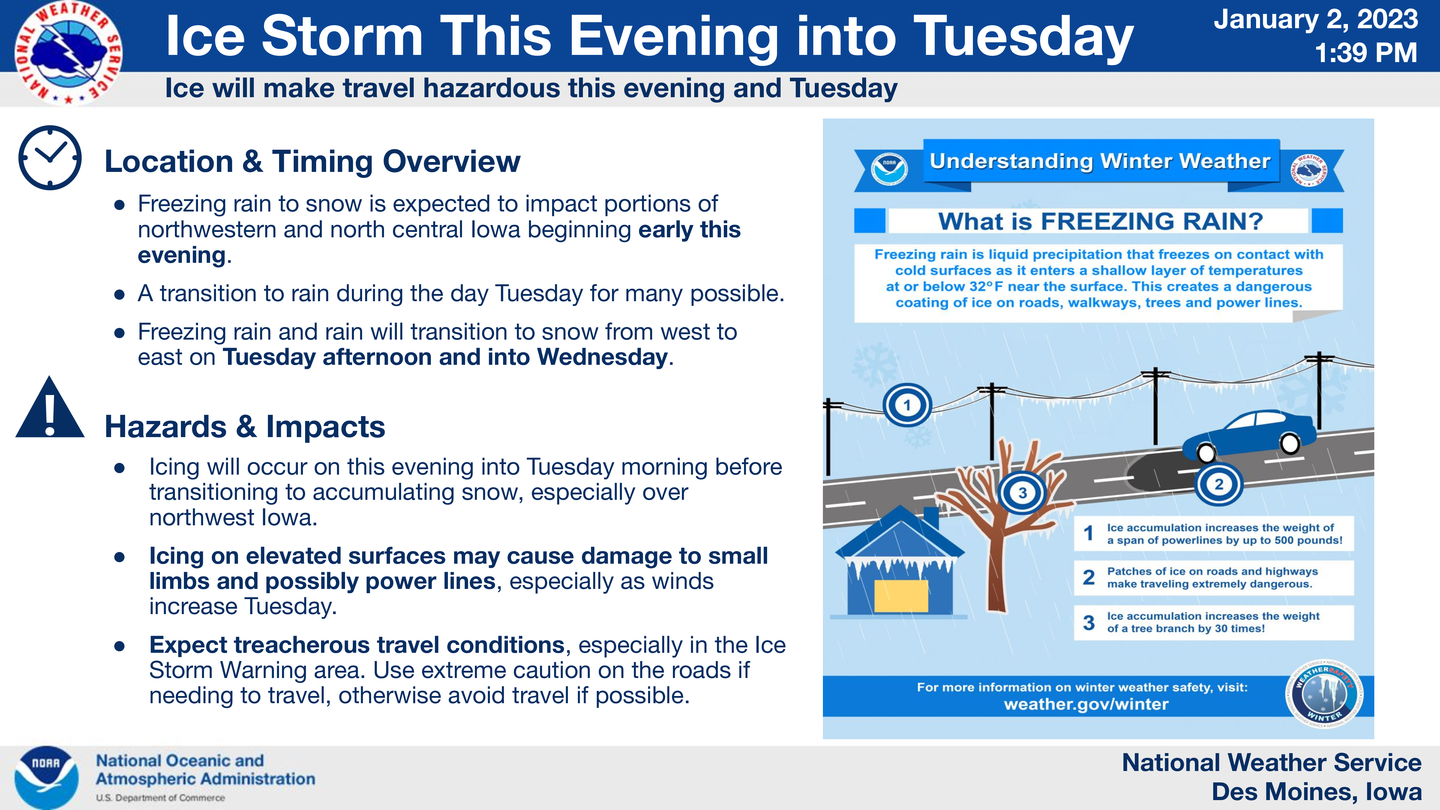
A winter storm will spread mixed precipitation across about the northwest half of Iowa and neighboring states through tonight and into Tuesday.
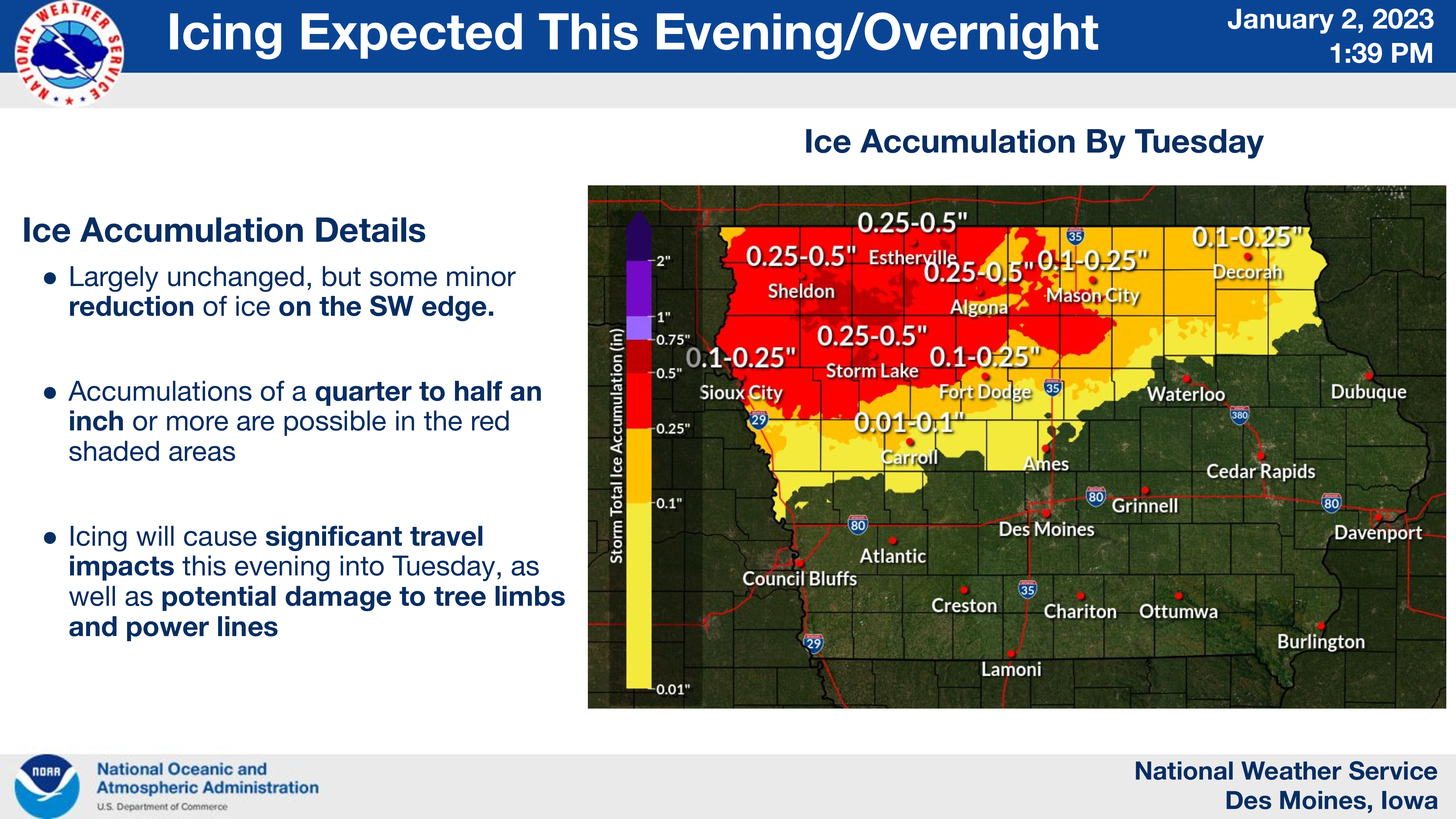
Much of the precipitation will fall as freezing rain from northwest into north central areas, with a mix of light snow at times. Significant ice accumulations are possible, resulting in treacherous travel conditions and potentially power outages.
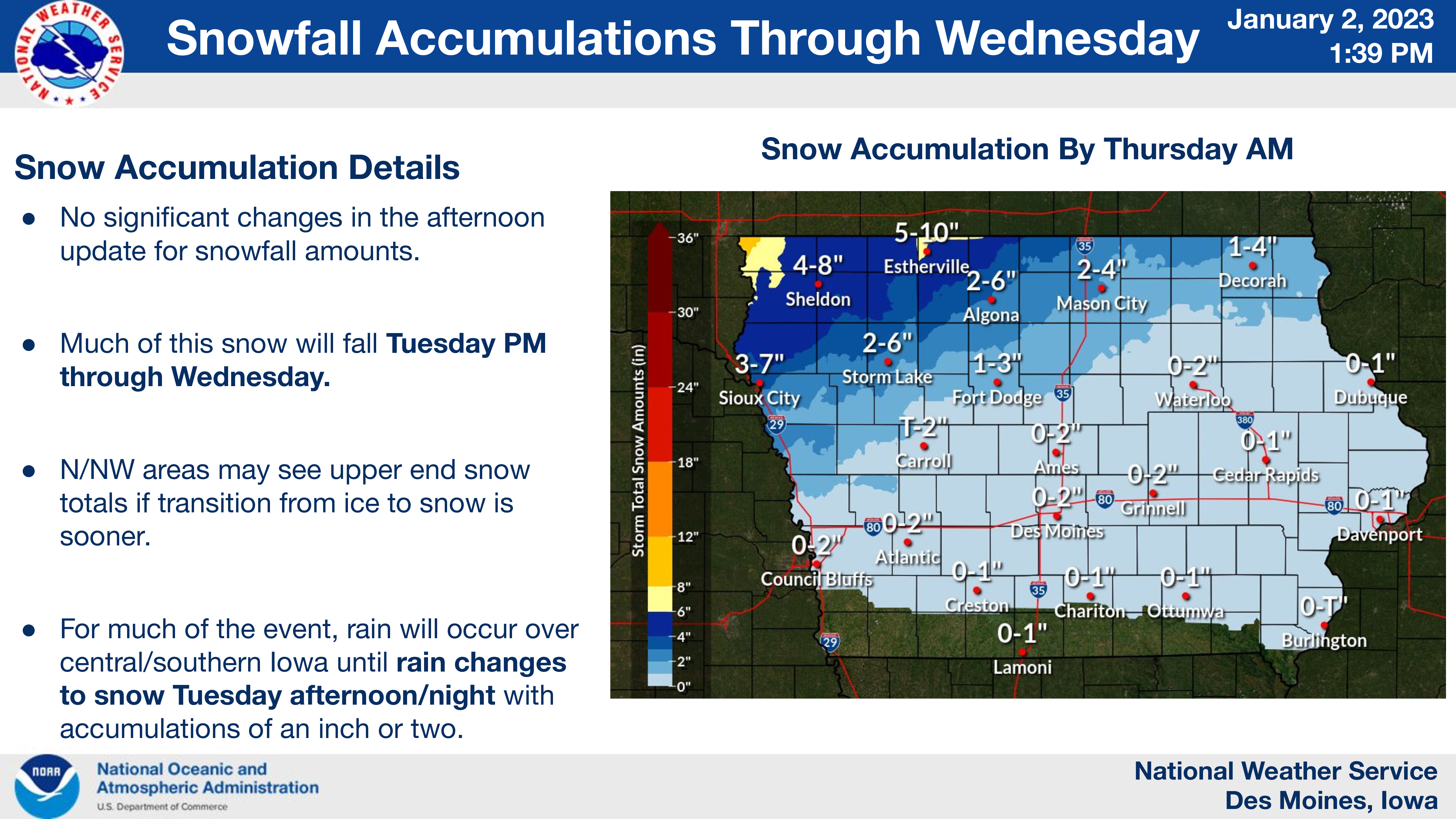
During the day Tuesday the precipitation will become lighter and end or change to rain in many areas, however, another round of wintry mix followed by widespread light to moderate snow is expected from Tuesday night through Wednesday.
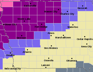
…ICE STORM WARNING UNTIL 6 PM TUESDAY FOR CERRO GORDO, WORTH, WINNEBAGO, HANCOCK, KOSSUTH, WRIGHT AND FRANKLIN COUNTIES…
Significant icing expected. Total ice accumulations of one quarter to one half of an inch and snow accumulations of one to two inches through Tuesday afternoon. Winds gusting as high as 30 mph at times.
…WINTER WEATHER ADVISORY UNTIL 6 PM TUESDAY FOR BUTLER, FLOYD, MITCHELL AND MOWER COUNTY IN SOUTHERN MINNESOTA…
Mixed precipitation expected. Total snow accumulations of up to one inch and ice accumulations of one tenth to two tenths of an inch.
…ICE STORM WARNING UNTIL MIDNIGHT TUESDAY FOR FREEBORN AND FARIBAULT COUNTIES IN SOUTHERN MINNESOTA…
Significant icing expected. Total snow accumulations of 4 to 8 inches in southeast Minnesota and 6 to 12 inches in southwest Minnesota. Ice accumulations of one to two tenths of an inch.
Power outages and tree damage are likely due to the ice. Travel could be very treacherous.
Travel is strongly discouraged. If you must travel, keep an extra flashlight, food and water in your vehicle in case of an emergency. Prepare for possible power outages.