⚠ Potential Blizzard, Stong Winds, and Extreme Cold Mid to Late Week ⚠
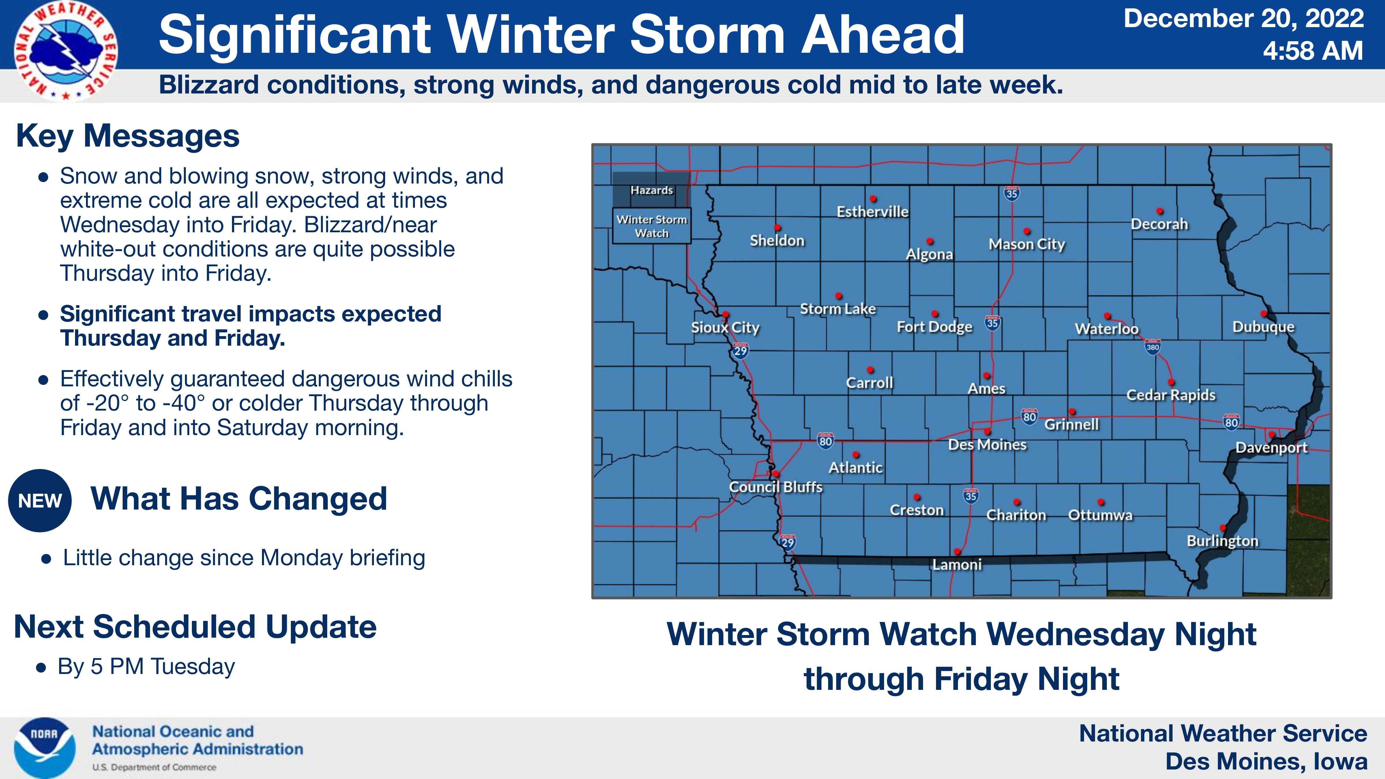
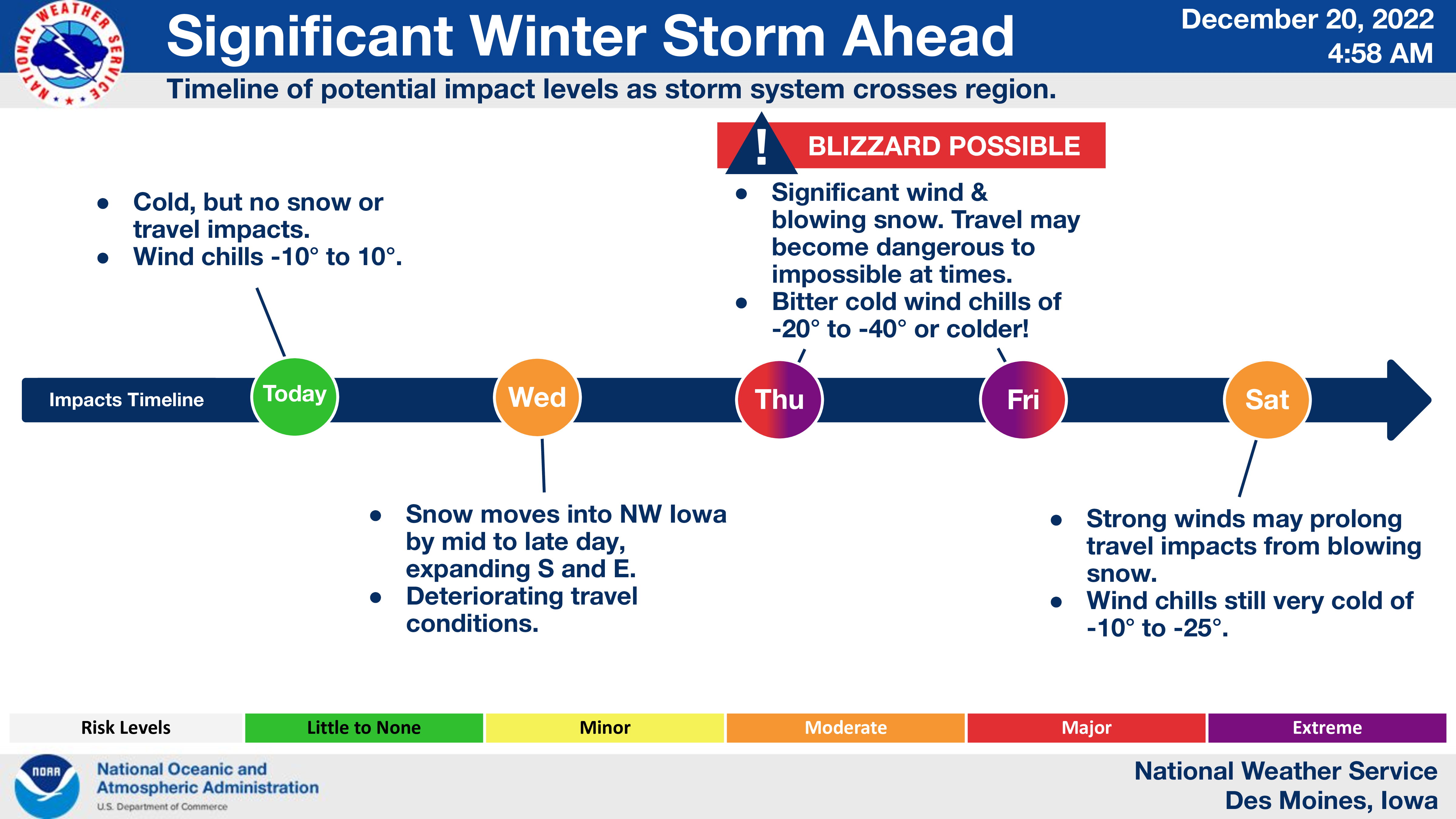
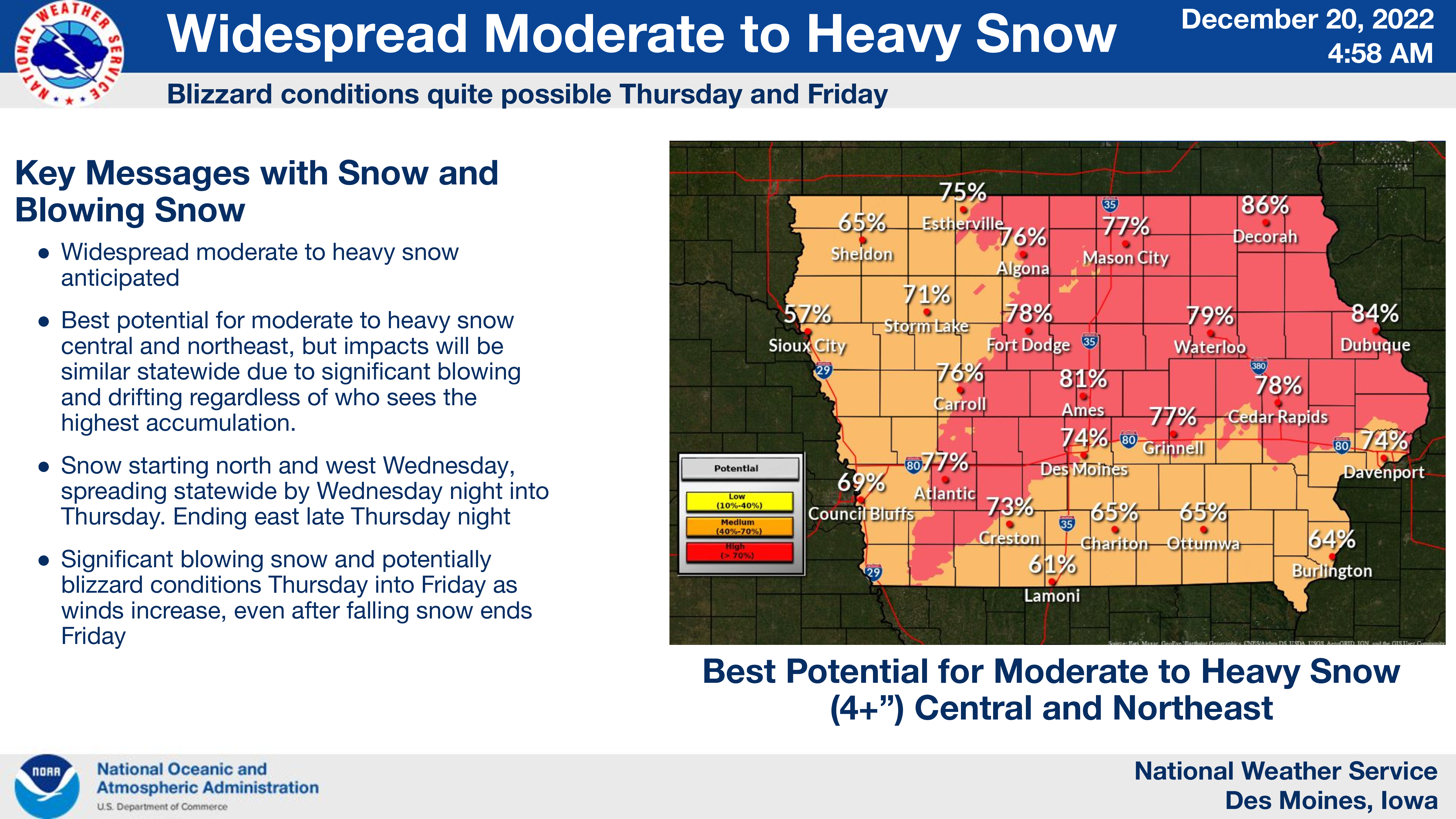
A significant winter storm is still on track to affect much of Iowa and the Midwest, starting Wednesday and lasting through the end of the week. Snow will begin north and west Wednesday afternoon and then progress into the remainder of the area into the night and Thursday.
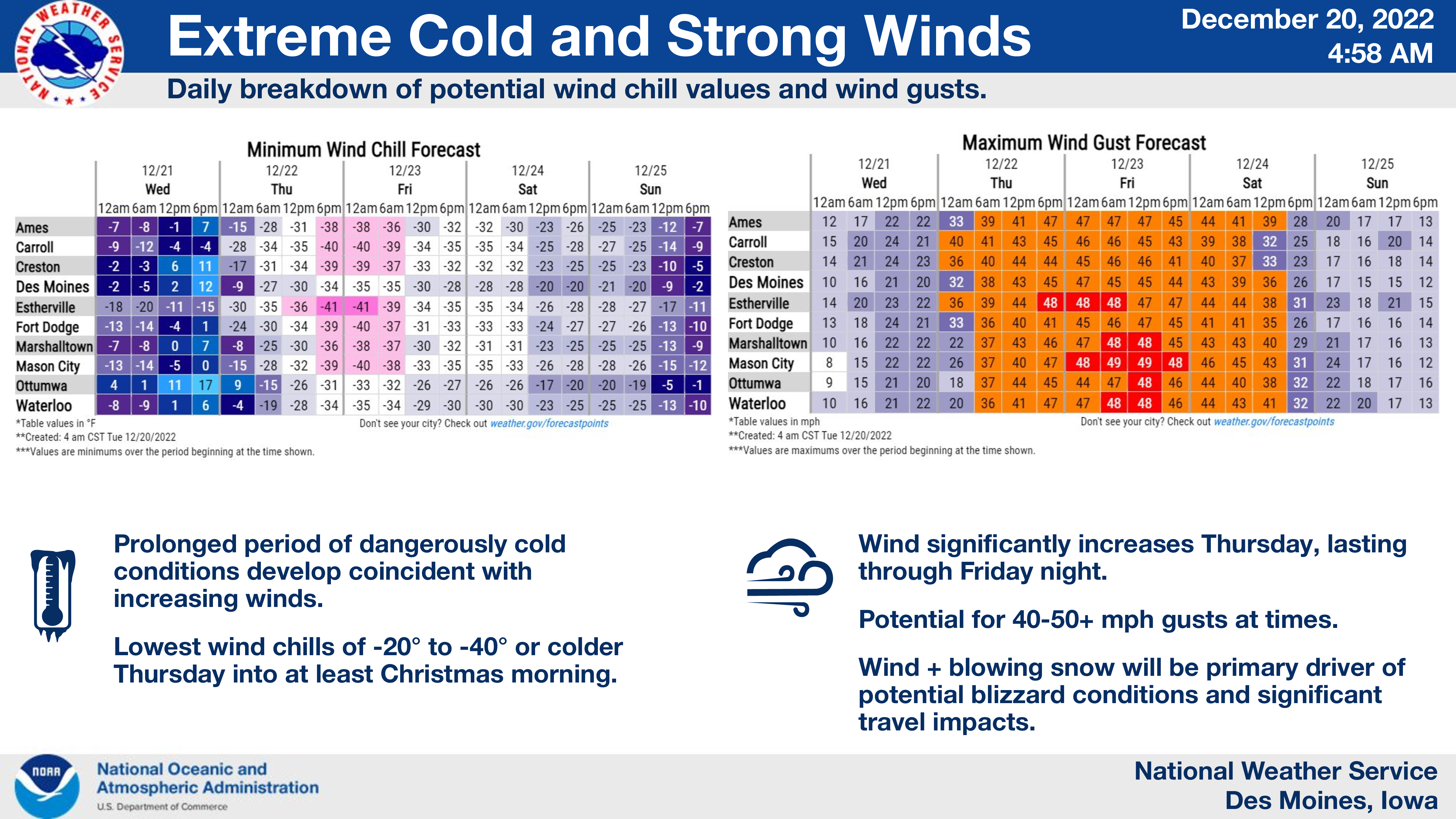
This will be followed by strong winds Thursday into Friday, gusting 40 to 50 mph, resulting in widespread blowing and drifting snow, with blizzard conditions likely. The strong winds will also drive wind chills into the 20 to 40 below zero range through at least Friday night.
The combination of near-white out conditions, strong winds, and extreme cold and wind chills concurrently will result in very dangerous travel conditions not to be taken lightly.
….WINTER STORM WATCH IN EFFECT FROM WEDNESDAY EVENING THROUGH LATE FRIDAY NIGHT FOR CERRO GORDO, WORTH, WINNEBAGO, HANCOCK, WRIGHT, FRANKLIN AND BUTLER COUNTIES…
Blizzard conditions possible. Total snow accumulations of 3 to 6 inches, with locally higher amounts possible. Wind gusts of 40 to 50 mph or greater may occur late Thursday through Friday. Extreme cold and wind chills of 20 to 40 below will be common.
…WINTER STORM WATCH FROM LATE WEDNESDAY NIGHT THROUGH LATE FRIDAY NIGHT FOR FLOYD, MITCHELL AND MOWER MN…
Blizzard conditions possible. Snow accumulations of 4 to 6 inches possible through Thursday night. Winds could gust as high as 55 mph.
….WINTER STORM WATCH IN EFFECT FROM WEDNESDAY AFTERNOON THROUGH LATE FRIDAY NIGHT FOR FREEBORN AND FARIBAULT MN…
Blizzard conditions possible. Total snow accumulations of 4 to 6 inches possible. Winds could gust as high as 55 mph.
For more and a complete county by county breakdown click below!