WINTER STORM WATCH from Sunday Night through Monday Afternoon for north Iowa and southern Minnesota
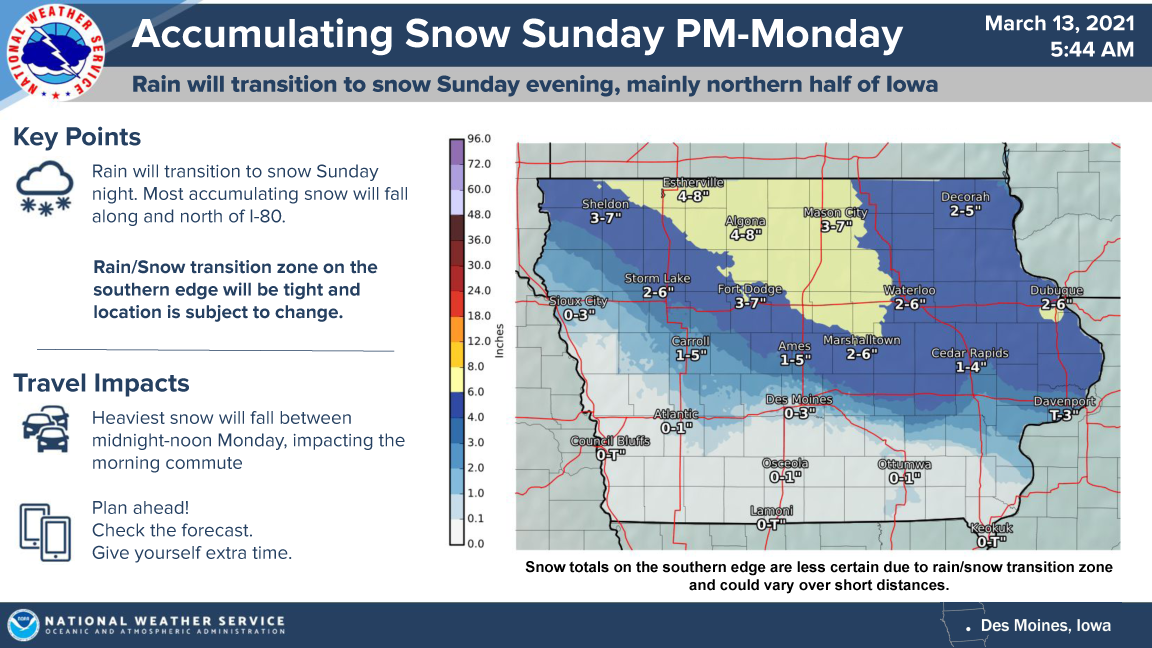
…Moderate to Heavy Snow to Impact Parts of Northern Iowa Sunday Evening into Monday… .A strong early spring storm system will impact Iowa Sunday and Monday. What begins as rain on Sunday will transition to snow Sunday evening with snow continuing through midday Monday. Most snow accumulation will occur along and north of interstate 80 with moderate to heavy snow accumulations possible across the watch area. The heaviest snow will fall between midnight and noon Monday, likely impacting the Monday morning commute.

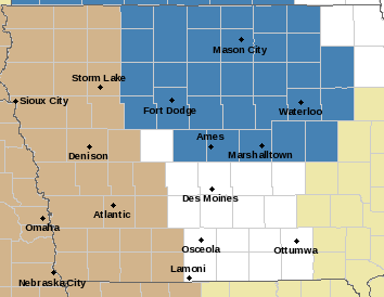
…WINTER STORM WATCH FROM LATE SUNDAY NIGHT THROUGH MONDAY AFTERNOON FOR CERRO GORDO, WORTH, WINNEBAGO, HANCOCK, WRIGHT, KOSSUTH, FRANKLIN AND BUTLER COUNTIES…
Heavy snow is possible. Total snow accumulations of 4 to 7 inches with isolated higher amounts possible near the Iowa Minnesota border. Winds could gust as high as 35 mph.
…WINTER STORM WATCH FROM SUNDAY NIGHT THROUGH MONDAY MORNING FOR FLOYD, MITCHELL AND MOWER MN…
Heavy wet snow is possible. Total snow accumulations of 4 to 7 inches possible. East winds gusting as high as 30 mph will likely create some drifting snow.
…WINTER STORM WATCH FROM LATE SUNDAY NIGHT THROUGH MONDAY AFTERNOON FOR FREEBORN AND FARIBAULT COUNTIES…
Heavy snow is possible. Total snow accumulations of 5 to 8 inches possible.