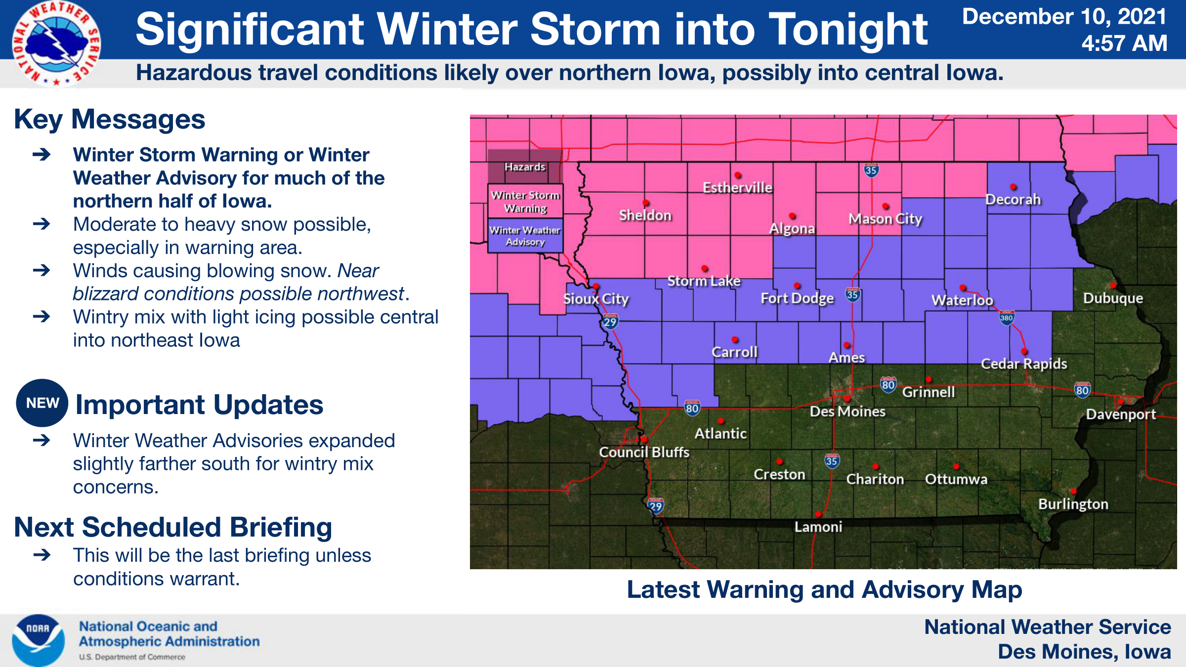
Significant Winter Storm For Northern Iowa and Southern Minnesota
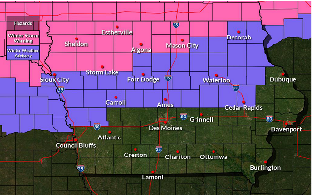

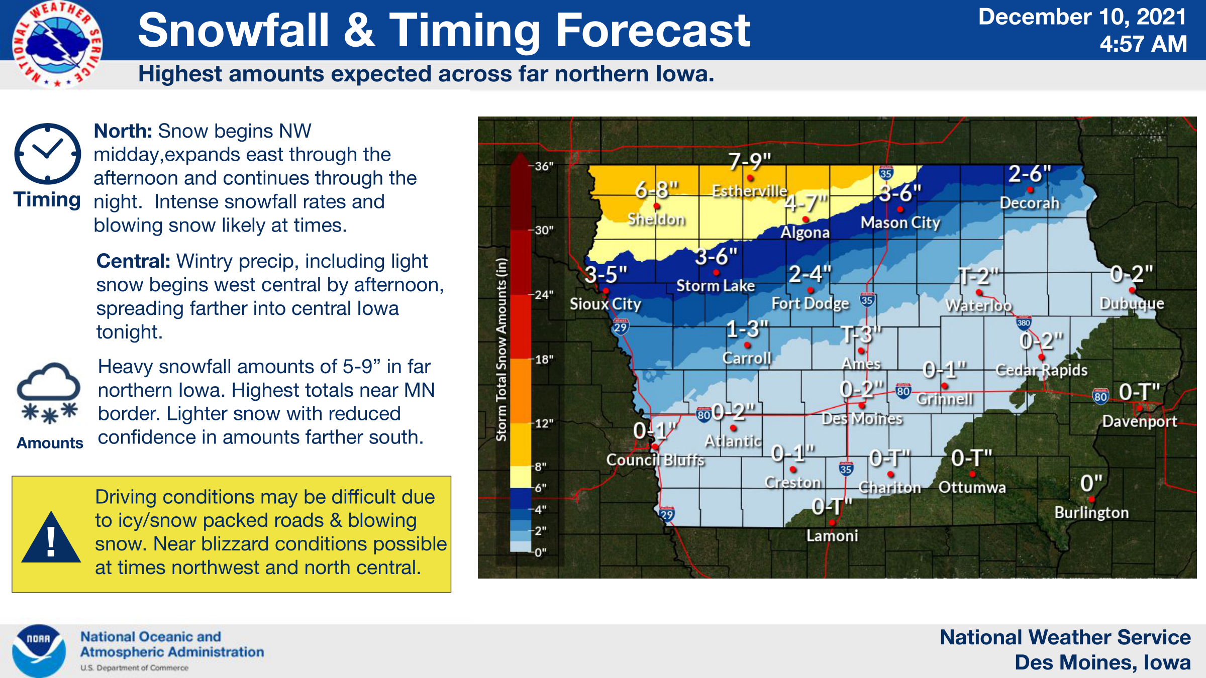
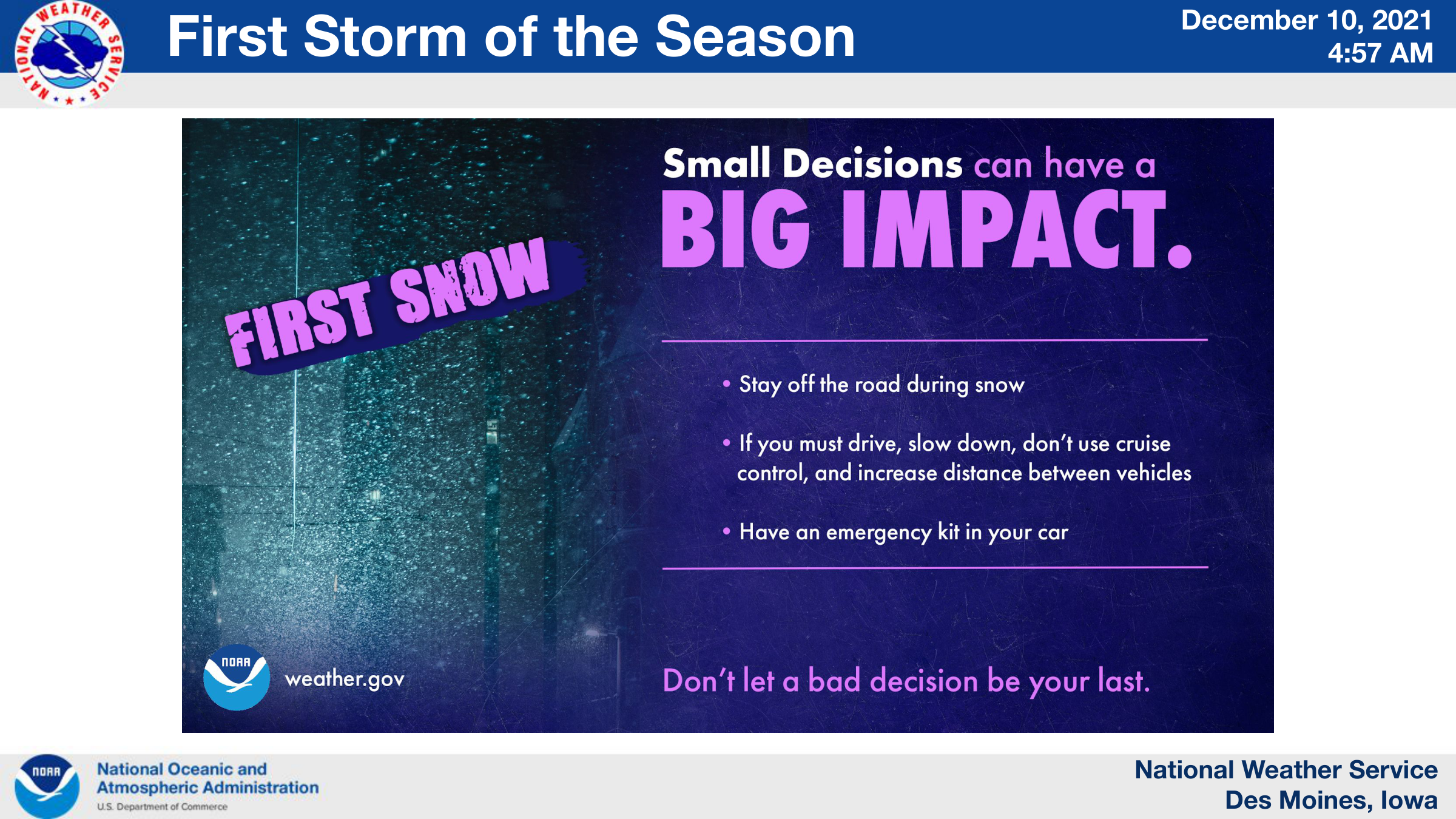
Heavy snow and blowing snow are expected across northern and especially northwest Iowa from midday today into tonight. Snowfall accumulations of 6 to 9 inches are possible there, which will combine with wind gusts of 30 to 35 mph producing considerable blowing snow and near blizzard conditions at times by tonight. A bit farther south, snow amounts will be less in the 2 to 5 inch range, but there may still be blowing snow. This will result in hazardous travel with snow covered roads and low visibilities, especially during the nighttime hours. A light wintry mix, with light freezing rain is also possible from just north and east of Des Moines toward the Waterloo area. Motorists are strongly advised to monitor the latest forecasts and road conditions before heading out in these areas, and possibly delay travel if possible.
…A WINTER STORM WARNING IS IN EFFECT UNTIL 6 AM SATURDAY FOR CERRO GORDO, WORTH, WINNEBAGO, HANCOCK AND KOSSUTH COUNTIES….
Heavy snow and blowing snow is expected. Total snow accumulations of 4 to 9 inches. Winds gusting as high as 35 mph.
…A WINTER STORM WARNING IS IN EFFECT UNTIL 6 AM SATURDAY FOR MITCHELL COUNTY…
Heavy snow is expected. Total snow accumulations of 4 to 6 inches. Winds gusting as high as 40 mph.
…A WINTER WEATHER ADVISORY IS IN EFFECT UNTIL 6 AM SATURDAY FOR FRANKLIN, WRIGHT AND BUTLER COUNTIES…
Mixed precipitation expected. Total snow accumulations of 1 to 4 inches and ice accumulations of a light glaze. Winds gusting as high as 35 mph.
…A WINTER STORM WARNING IS IN EFFECT UNTIL 6 AM SATURDAY FOR MOWER COUNTY IN SOUTHERN MINNESOTA…
Heavy snow is expected. Total snow accumulations of 6 to 12 inches. Winds gusting as high as 40 mph.
…A WINTER STORM WARNING IS IN EFFECT UNTIL 6 AM SATURDAY FOR FREEBORN AND FARIBAULT COUNTIES IN SOUTHERN MINNESOTA…
Heavy snow is expected. Total snow accumulations of 8 to 14 inches.
For more information on the alerts in effect for your area click below!