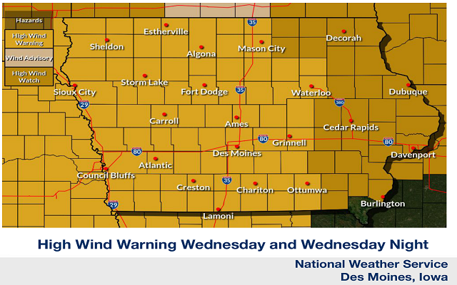
A HIGH WIND WARNING Is In Effect For Portions Of Northern Iowa Wednesday Afternoon And Wednesday Night.
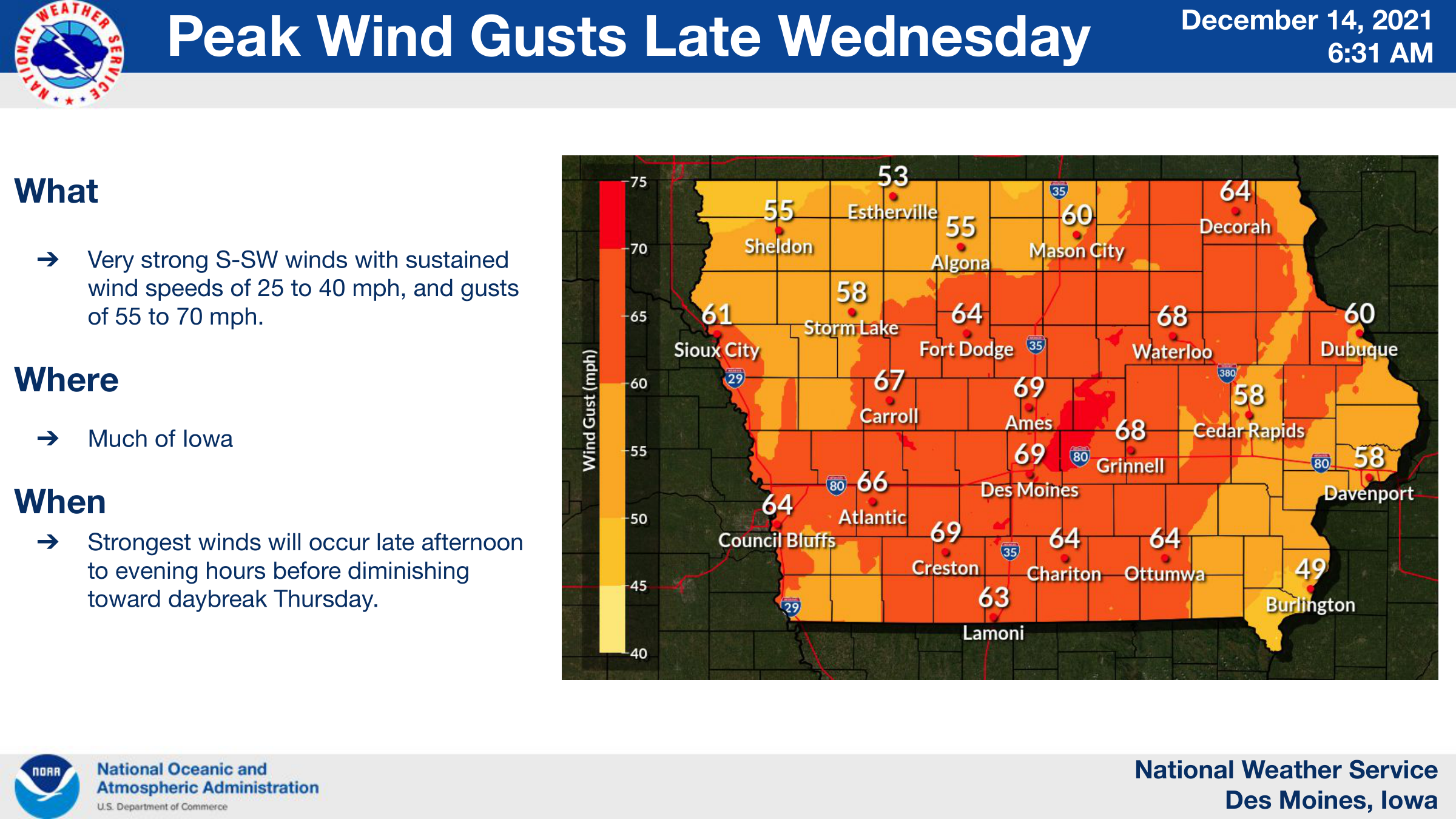
Strong winds are expected across much of central Iowa in the late afternoon through the evening Wednesday with gusts of 55 to 70 mph expected. Record breaking temperatures are also expected as highs reach the upper 50s north and in the lower 70s south. Showers and thunderstorms are possible in the late afternoon through the evening. There is now a risk for some severe weather over portions of Iowa Wednesday.
…HIGH WIND WARNING IN EFFECT FROM 3 PM WEDNESDAY TO 3 AM CST THURSDAY FOR CERRO GORDO, WORTH, WINNEBAGO, HANCOCK, KOSSUTH, WRIGHT, FRANKLIN AND BUTLER COUNTIES…
Southwest winds 25 to 40 mph with gusts over 60 mph expected. Damaging winds will blow down trees and power lines. Widespread power outages are expected. Travel will be difficult, especially for high profile vehicles.
People should avoid being outside in forested areas and around trees and branches. If possible, remain in the lower levels of
your home during the windstorm, and avoid windows. Use caution if you must drive.
For more on the alerts currently in effect for our area click below!
https://www.mystar106.com/a-high-wind-warning-for-is-in-effect-much-of-northern-iowa-wednesday-and-wednesday-night-a-wind-advisory-for-southern-minnesota-click-for-details/