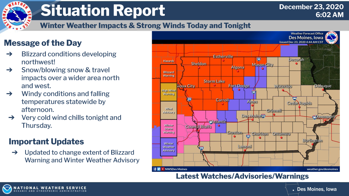
A BLIZZARD WARNING, WINTER WEATHER ADVISORY and WIND ADVISORY for all of northern Iowa through Midnight Tonight.
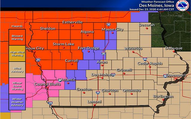
A BLIZZARD WARNING is in effect until Midnight tonight for Worth, Winnebago, Hancock and Kossuth Counties.
Blizzard conditions expected. Total snow accumulations of 2 to 4 inches with the higher totals nearer the Iowa Minnesota border. Winds gusting as high as 50 to 55 mph.
A WINTER WEATHER ADVISORY is in effect until Midnight tonight for Cerro Gordo, Wright and Franklin counties.
Snow expected. Total snow accumulations of up to 2 inches. Winds gusting as high as 45 mph.
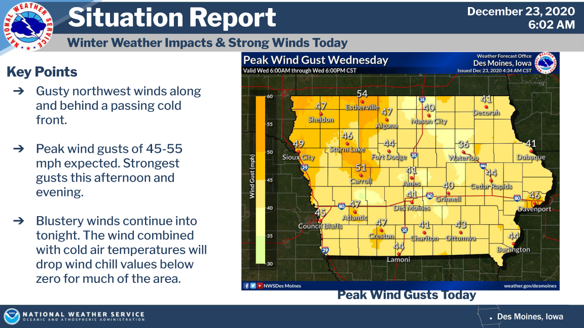
A BLIZZARD WARNING is in effect until 6:00 AM Thursday for Freeborn and Faribault county in southern Minnesota.
Blizzard conditions expected. Total snow accumulations of 3 to 5 inches. Winds gusting as high as 55 mph.
A BLIZZARD WARNING is in effect until 2:00 AM Thursday for Mower county in Southern Minnesota.
Blizzard conditions expected. Total snow accumulations of 1 to 4 inches and ice accumulations or freezing of moisture on roads to a light glaze. Winds gusting as high as 50 mph.
A WIND ADVISORY is in effect until Midnight tonight for Floyd, Mitchell and Butler counties.
West winds 25 to 30 mph with gusts up to 45 mph expected.
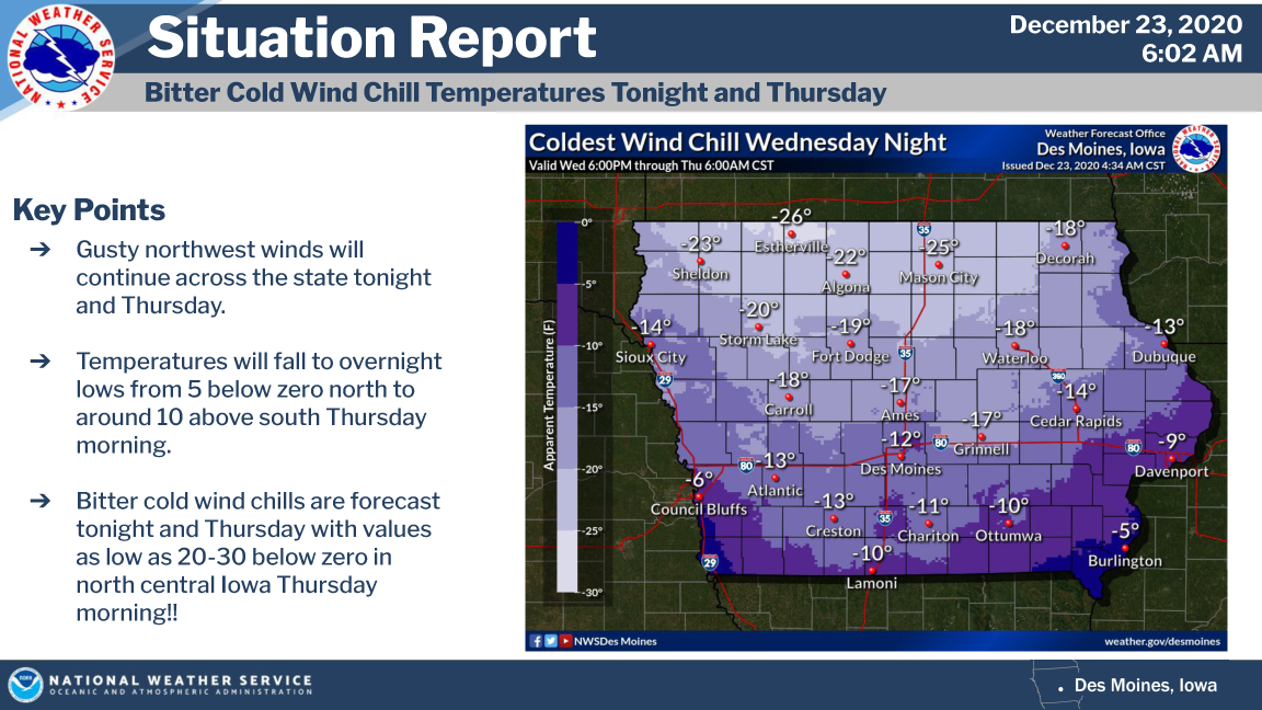
Get a more detailed county by county breakdown by click on “Weather Alert” below!