❄ WINTER STORM WARNING in effect until 9 AM this morning ❄
…Moderate to Heavy Snow along with Mixed Precipitation Today through Thursday Morning…
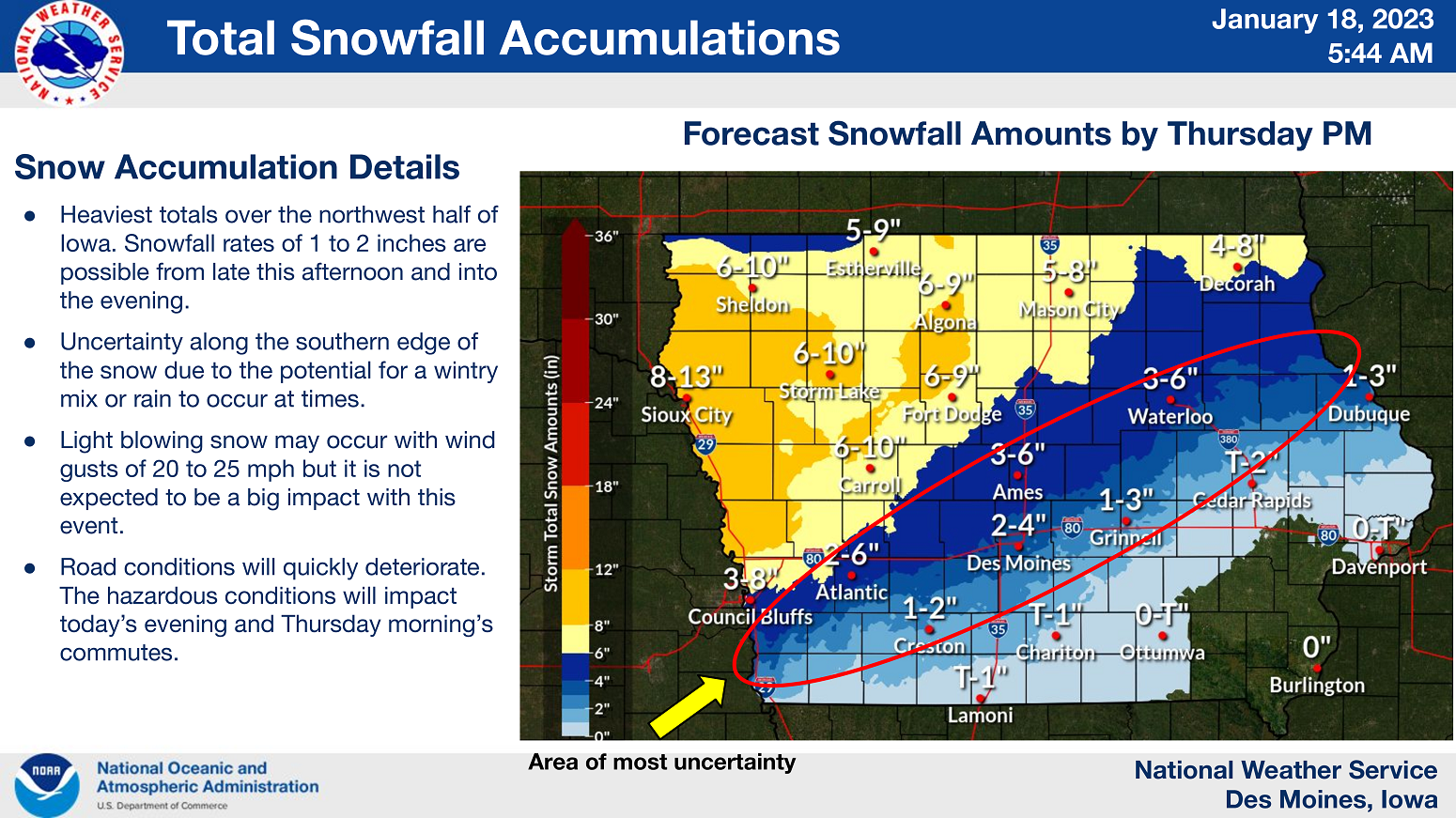
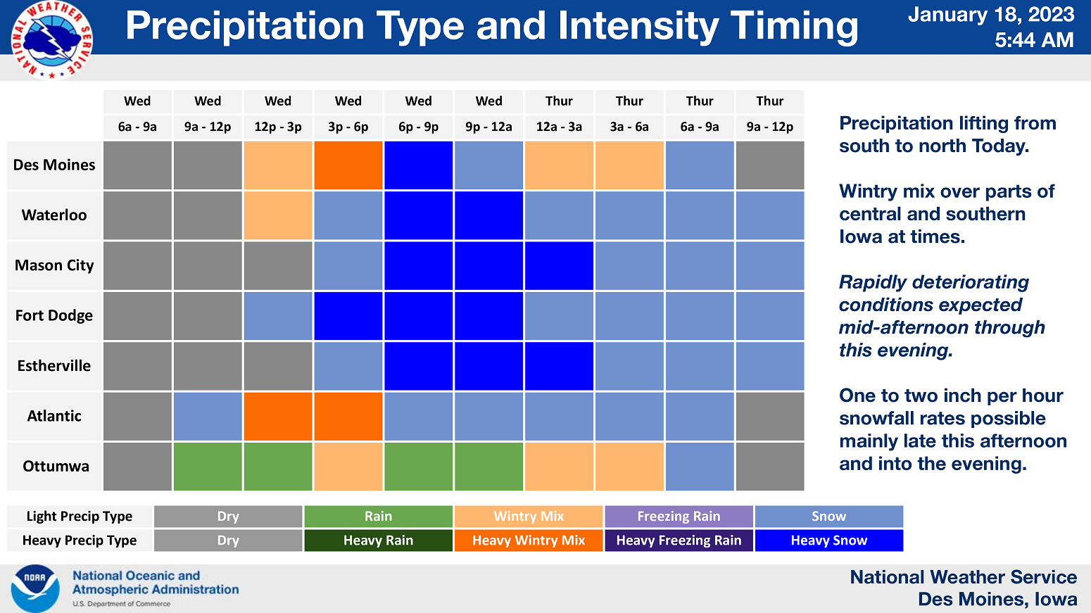
A wintry mix of snow, freezing rain and some rain will spread northward across much of southern and central Iowa by this afternoon, becoming all snow across northern Iowa.
Snowfall rates of 1 to 2 inches per hour at times are expected at times from early this evening and on through the evening, mainly across central and northern Iowa.
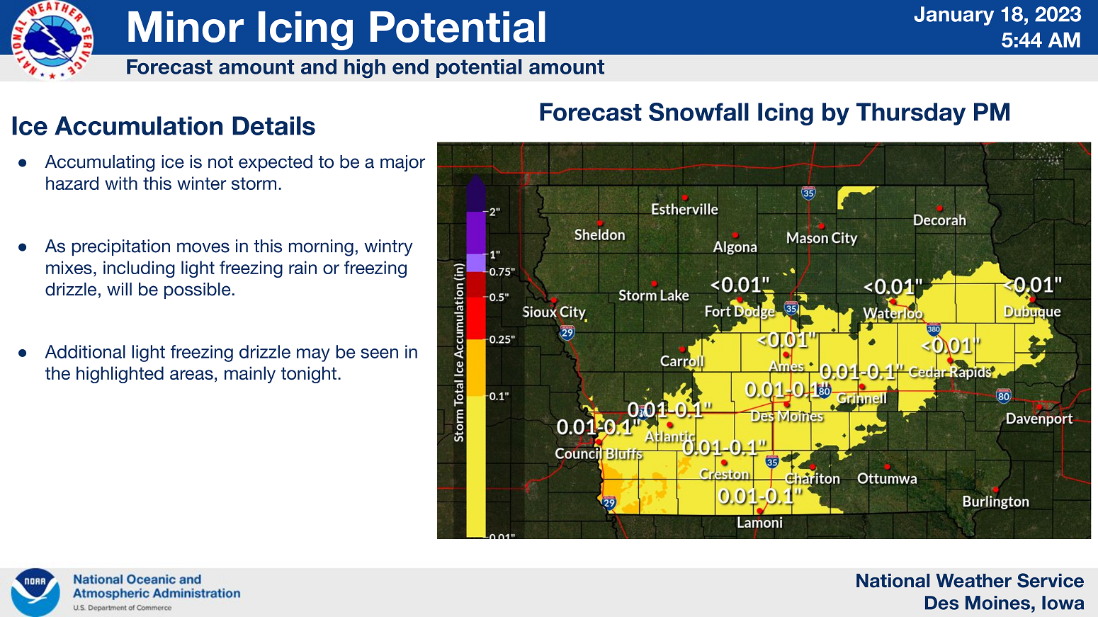
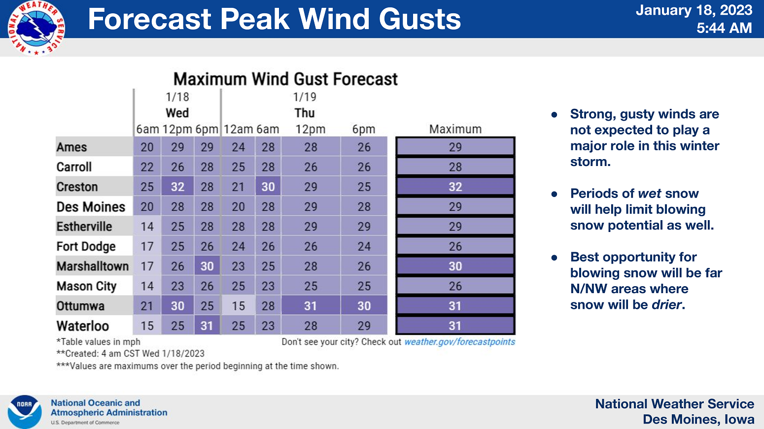
A light glazing of ice is also possible especially over the south tonight as freezing drizzle becomes possible. Some minor blowing snow may occur with wind gusts in the 20 to 25 mph range but it is not expected to be a significant impact with this event. The snow will gradually end from southwest to northeast on Thursday.

…WINTER STORM WARNING IN EFFECT UNTIL 9 AM THURSDAY FOR CERRO GORDO, WORTH, WINNEBAGO, HANCOCK, WRIGHT, KOSSUTH, FRANKLIN AND BUTLER COUNTIES…
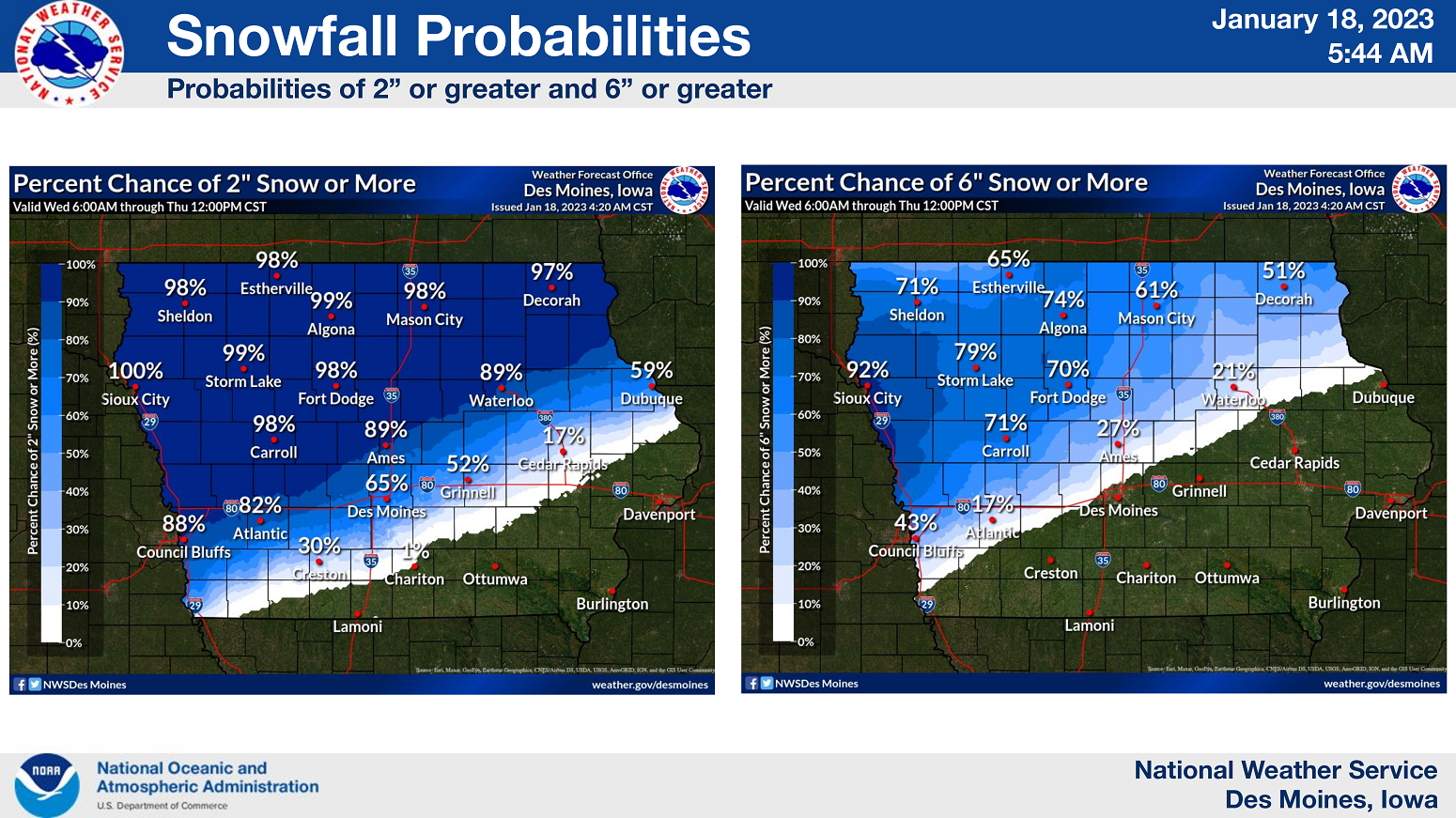
Moderate to heavy snow. Total snow accumulations of 5 to 8 inches.
…WINTER STORM WARNING IN EFFECT UNTIL 9 AM THURSDAY FOR FLOYD, MITCHELL AND MOWER MN…
Heavy mixed precipitation expected. Total snow accumulations of 4 to 8 inches and ice accumulations of a light glaze.
…WINTER STORM WARNING IN EFFECT UNTIL 3 PM THURSDAY FOR FREEBORN AND FARIBAULT COUNTIES IN SOUTHERN MINNESOTA…
Heavy snow is expected. Total snow accumulations of 4 to 7 inches.
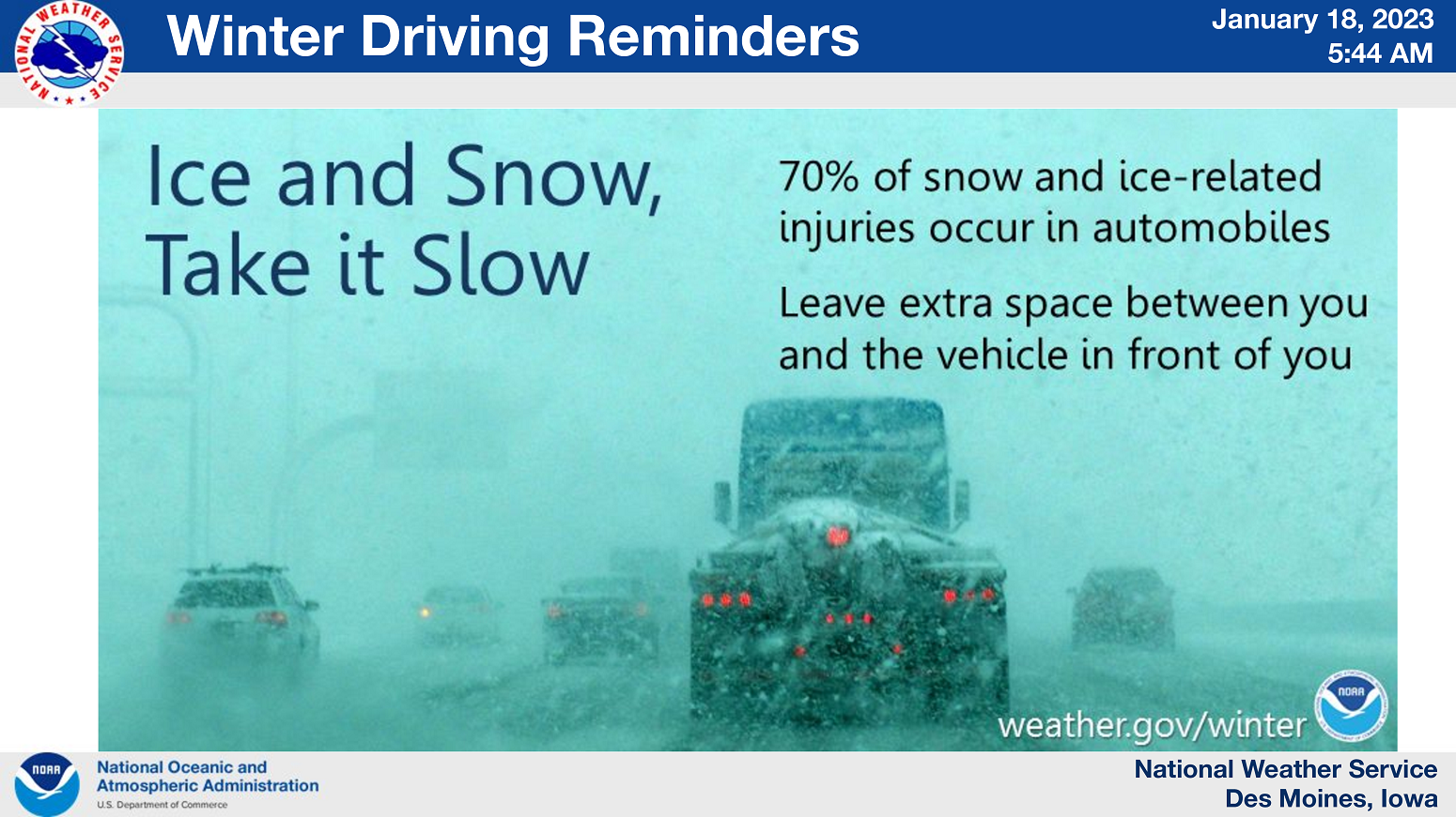
Snowfall rates of 1 to 2 inches per hour at times are expected at times this evening. Travel could be very difficult. If you must travel, keep an extra flashlight, food and water in your vehicle in case of an emergency.