❄ Snow, heavy at times Thursday into Thursday night
…Heavy Snowfall Expected Across Portions of Central into Northern Iowa Thursday into Thursday…
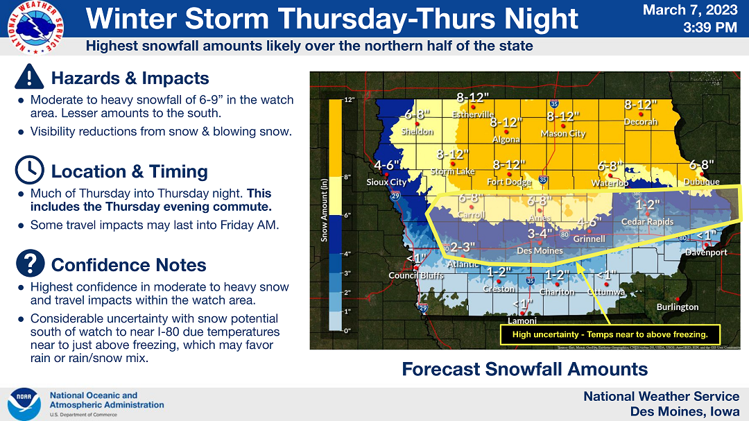
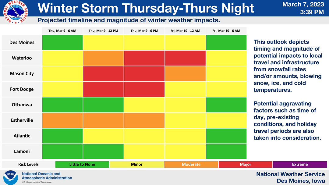
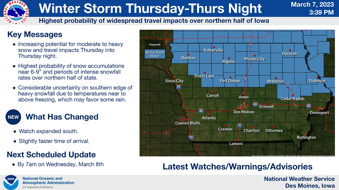
A winter storm will create hazardous impacts across portions of the state Thursday into Thursday night. The potential for moderate to heavy snowfall and significant travel impacts resides across the northern half of the state where snowfall amounts may approach 9 inches in some areas. Snowfall rates may be intense at times Thursday afternoon into the evening, which could further degrade driving conditions for the evening commute.
Considerable uncertainty remains with snowfall potential and severity of travel impacts just south of the watch area, where temperatures will be near to just above freezing. Those with travel interests within and near the watch area should pay close attention for forecast updates and be prepared for winter driving conditions or consider alternative plans.
….WINTER STORM WATCH FROM THURSDAY MORNING THROUGH LATE THURSDAY NIGHT FOR CERRO GORDO, WORTH, WINNEBAGO, HANCOCK, WRIGHT, KOSSUTH, FRANKLIN AND BUTLER COUNTIES COUNTIES…
Heavy snow is possible. Total snow accumulations of 6 to 9 inches possible. Strong winds may produce blowing snow as well, reducing visibilities..
…WINTER STORM WATCH FROM THURSDAY AFTERNOON THROUGH LATE THURSDAY NIGHT FOR FLOYD, MITCHELL AND MOWER MN…
Heavy snow is possible. Total snow accumulations of 7 to 10 inches possible.
….WINTER STORM WATCH FROM THURSDAY AFTERNOON THROUGH FRIDAY MORNING FOR FARIBAULT AND FREEBORN COUNTIES IN SOUTHERN MINNESOTA…
Heavy snow is possible. Total snow accumulations of 4 to 7 inches possible.
Travel could be very difficult. Patchy blowing snow could significantly reduce visibility. The hazardous conditions could impact the evening commute across the entire watch area.