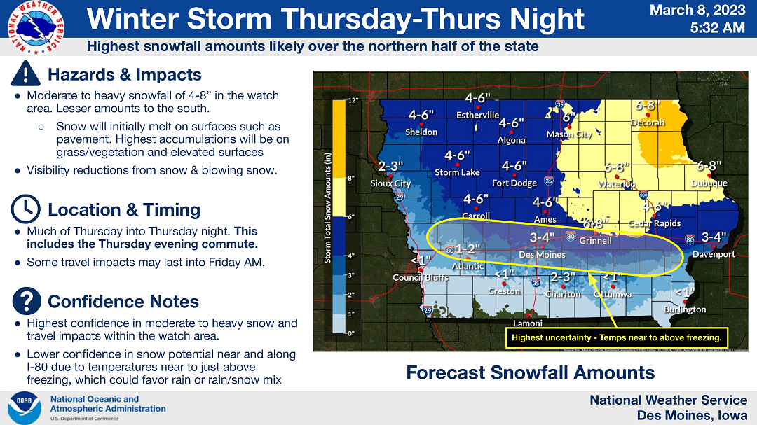
❄ Moderate to heavy snow accumulations are expected by Thursday night
..Winter Storm Expected Portions of Northern and Central Iowa on Thursday into Thursday Night…
A storm is expected to spread precipitation into Iowa toward daybreak on Thursday. The precipitation is expected to expand statewide during the day with rain in the far south, rain and snow mixed in portions of southern and central Iowa and mainly snow across the north half of the state. Moderate to heavy snow accumulations are expected in the watch area by Thursday night.
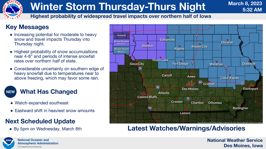
….WINTER STORM WATCH FROM THURSDAY MORNING THROUGH LATE THURSDAY NIGHT FOR CERRO GORDO, WORTH, WINNEBAGO, HANCOCK, WRIGHT, KOSSUTH, FRANKLIN AND BUTLER COUNTIES COUNTIES…
Heavy snow is possible. Total snow accumulations of 5 to 7 inches possible. Strong winds may produce blowing snow as well, reducing visibility.
…WINTER STORM WATCH FROM THURSDAY MORNING THROUGH LATE THURSDAY NIGHT FOR FLOYD, MITCHELL AND MOWER MN…
Heavy snow is possible. Total snow accumulations of 4 to 7 inches possible.
….WINTER STORM WATCH FROM THURSDAY MORNING THROUGH LATE THURSDAY NIGHT FOR FARIBAULT AND FREEBORN COUNTIES IN SOUTHERN MINNESOTA…
Heavy snow is possible. Total snow accumulations of 4 to 7 inches possible.
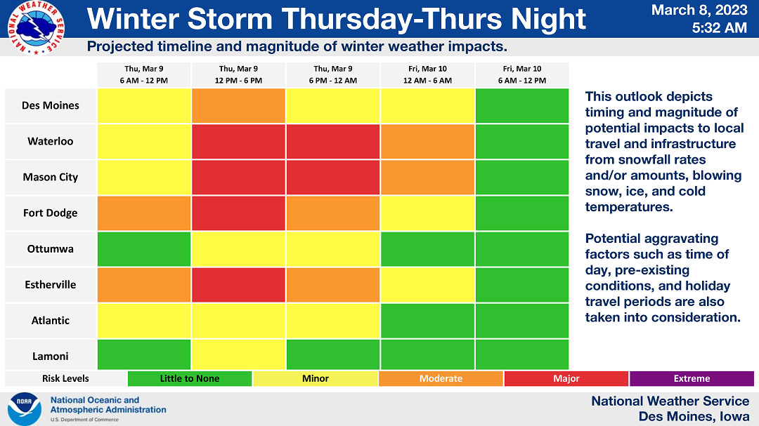
Travel could be very difficult. Patchy blowing snow could significantly reduce visibility. The hazardous conditions could impact the evening commute. Monitor the latest forecasts and stay with Star 106 for updates on this situation.