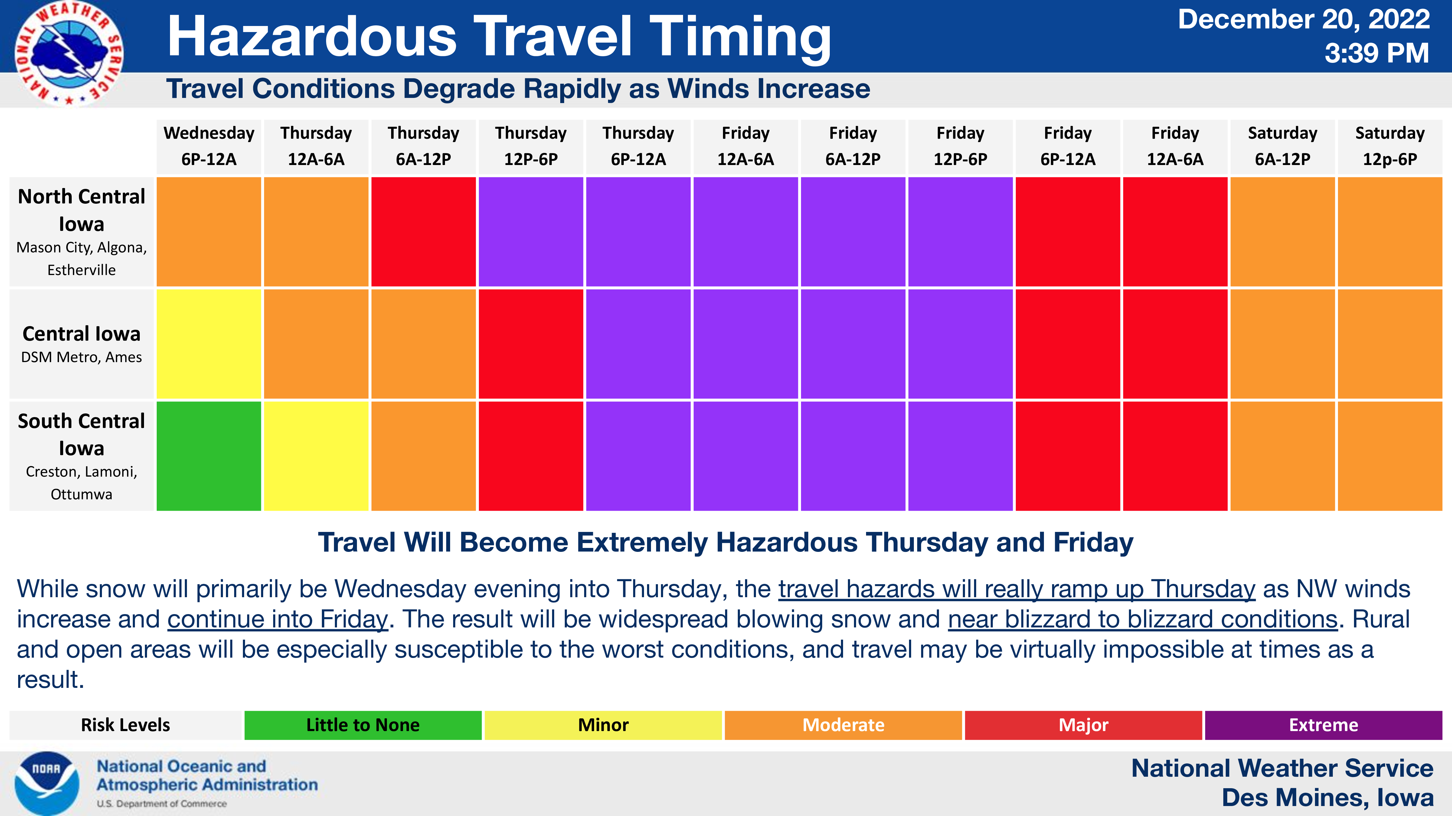
⚠ Blizzard conditions, extreme cold, and strong winds ⚠
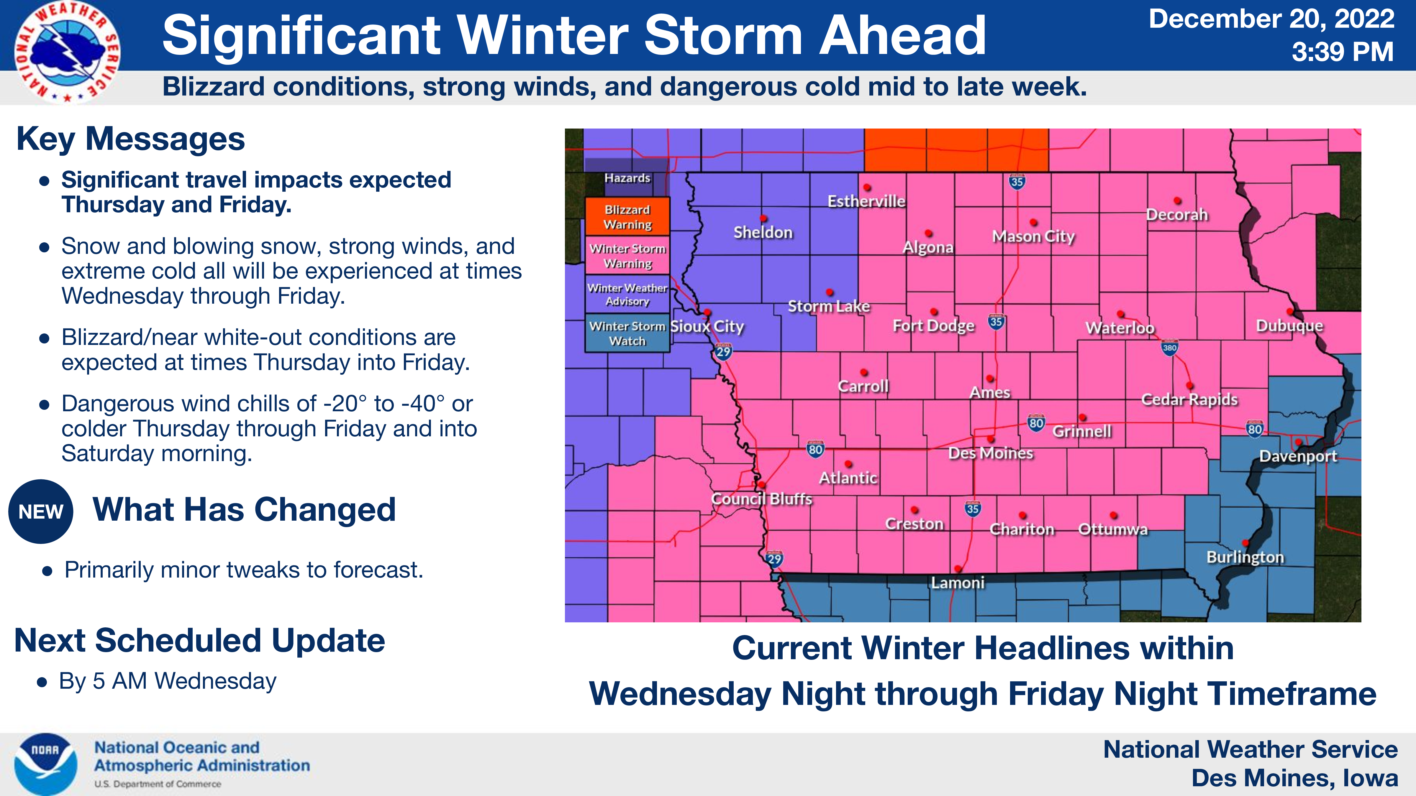
….WINTER STORM WARNING IN EFFECT FROM NOON WEDNESDAY UNTIL 6 AM SATURDAY FOR CERRO GORDO, WORTH, WINNEBAGO, HANCOCK, WRIGHT, KOSSUTH AND FRANKLIN COUNTIES…
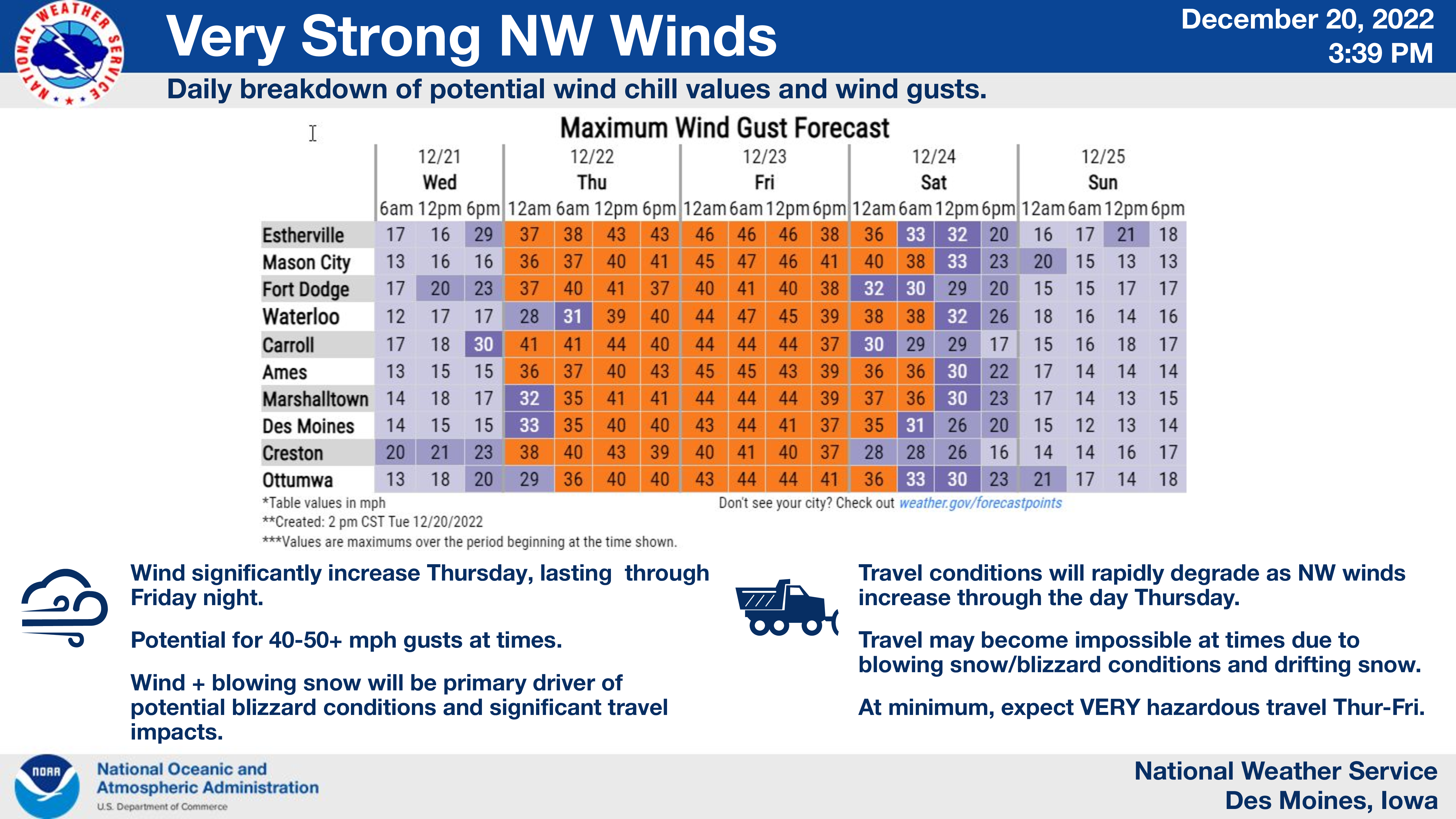
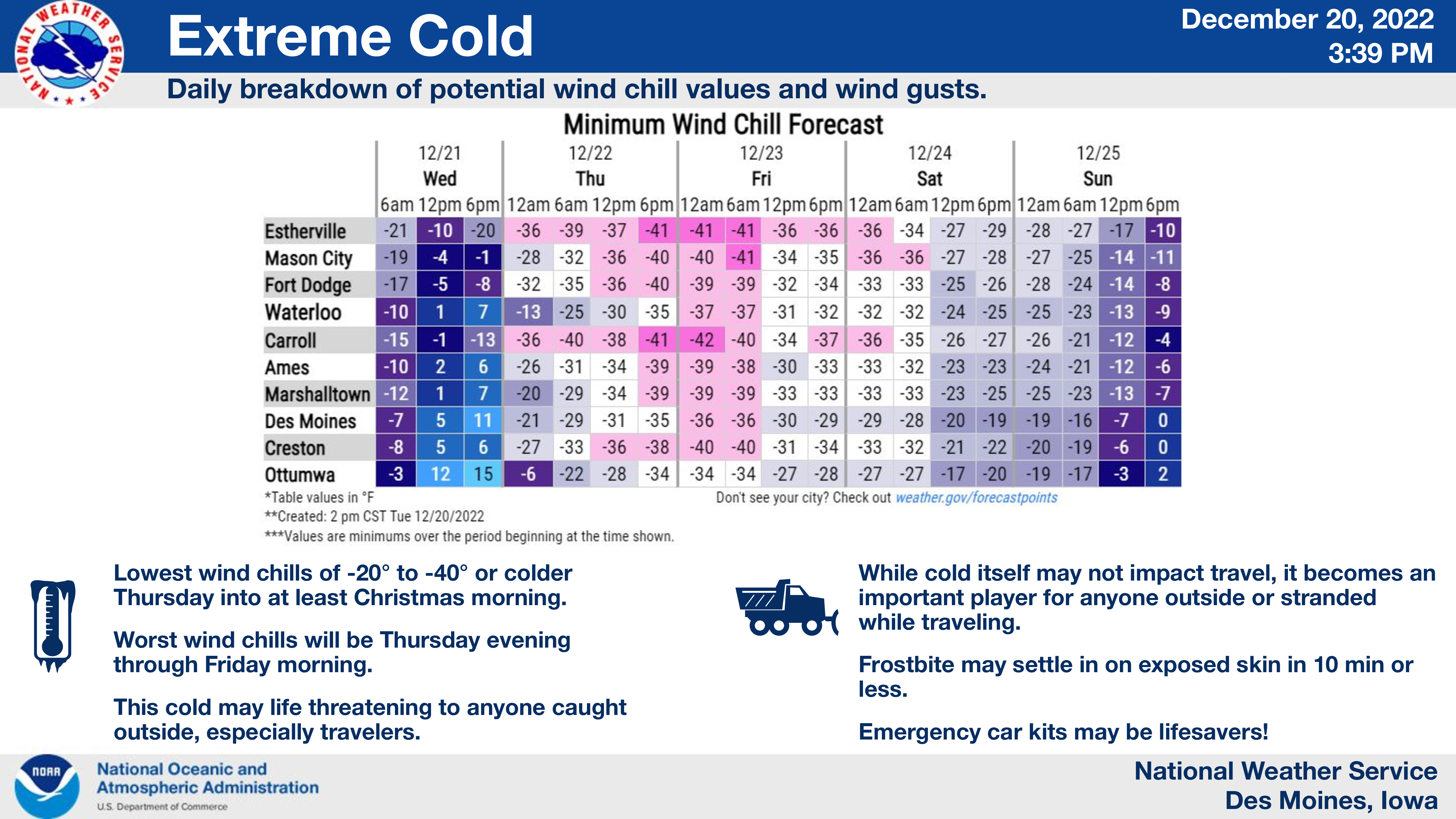
Snow and blowing snow will begin around noon on Wednesday and continue into Friday night. Blizzard conditions possible Thursday morning into Friday. Total snow accumulations of 3 to 6 inches, with locally higher amounts possible. Wind gusts of 40 to 50 mph or greater may occur late Thursday through Friday. Extreme cold and wind chills of 20 to 40 below will be common.
….WINTER STORM WARNING IN EFFECT FROM 6 PM WEDNESDAY UNTIL 6 AM SATURDAY FOR BUTLER COUNTY…
Snow and blowing snow will begin late Wednesday afternoon and continue through Friday night. Blizzard conditions possible Thursday morning into Friday. Total snow accumulations of 3 to 6 inches, with locally higher amounts possible. Wind gusts of 40 to 50 mph or greater may occur late Thursday through Friday. Extreme cold and wind chills of 20 to 40 below will be common.
…WINTER STORM WARNING IN EFFECT FROM 6 PM WEDNESDAY TO 6 AM SATURDAY FOR FLOYD MITCHELL AND MOWER MN…
Heavy snow is expected. Wednesday night. Blizzard conditions possible Thursday through Friday. Total snow accumulations of 4 to 6 inches. Winds gusting as high as 45 mph.
…WINTER STORM WARNING IN EFFECT FROM 9 AM WEDNESDAY TO NOON CST THURSDAY… BLIZZARD WARNING IN EFFECT FROM NOON THURSDAY TO 6 AM CST SATURDAY FOR FREEBORN AND FARIBAULT…
For the Winter Storm Warning, heavy snow is expected. Total snow accumulations of 5 to 8 inches. Winds gusting as high as 35 mph. For the Blizzard Warning, blizzard conditions are expected. Winds gusting as high as 50 mph.
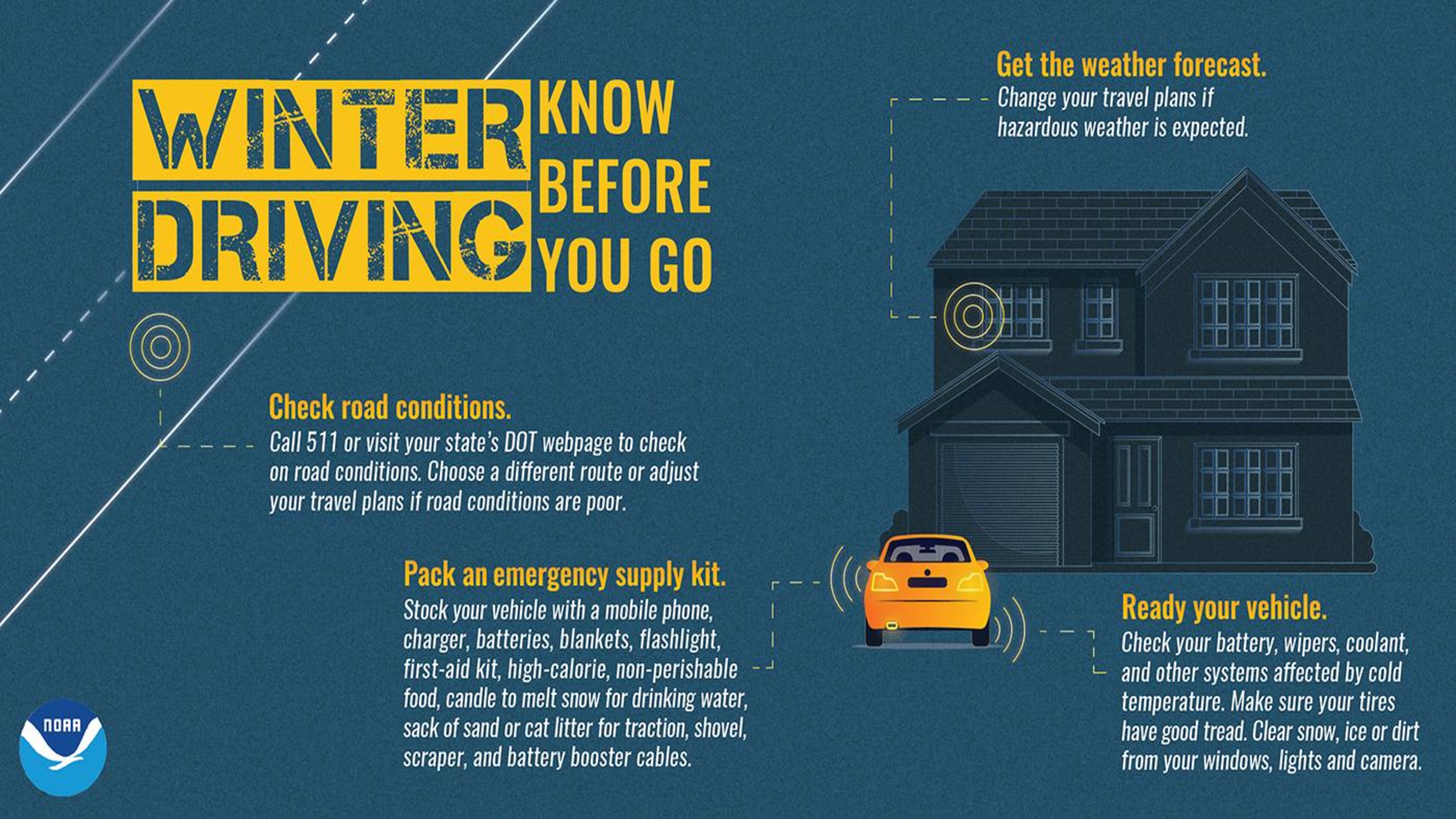
THOSE WITH HOLIDAY TRAVEL PLANNED FROM LATE WEDNESDAY THROUGH FRIDAY ARE STRONGLY ENCOURAGED TO PAY CLOSE ATTENTION TO FORECAST UPDATES AND ROAD CONDITIONS, AND PREPARE ACCORDINGLY IF TRAVEL IS A MUST. ALTERING TRAVEL PLANS, IF POSSIBLE, IS STRONGLY ENCOURAGED.