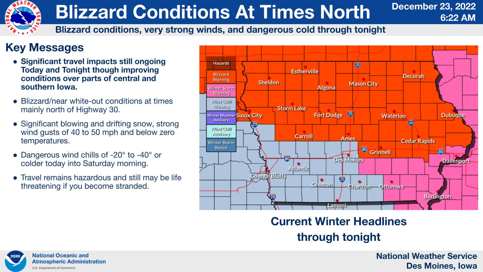
⚠ Blizzard Conditions, very strong winds and dangerous cold through tonight ⚠
….BLIZZARD WARNING IN EFFECT UNTIL 6 AM SATURDAY….WIND CHILL WARNING FROM 6 AM UNTIL NOON SATURDAY…FOR THE ENTIRE LISTENING AREA…
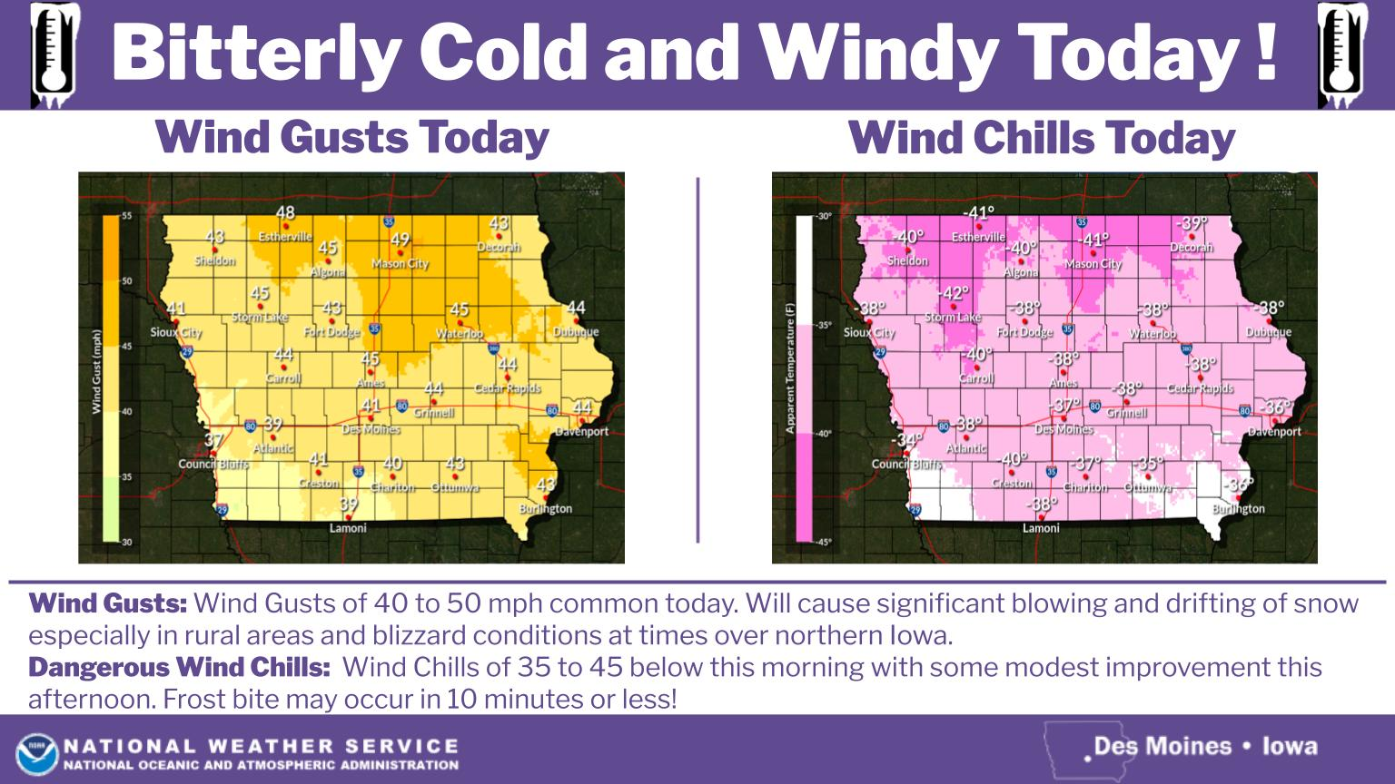
For the Blizzard Warning, blizzard conditions at times, especially in rural areas. Significant drifting snow. Winds gusting as high as 50 mph. For the Wind Chill Warning, dangerously cold wind chills are expected. Wind chills 25 to 45 below zero.
Widespread blowing snow could significantly reduce visibility to white out at times. The hazardous conditions will impact the morning or evening commute. Strong winds could bring down tree branches. The dangerously cold wind chills could cause frostbite on exposed skin in as little as 10 minutes.
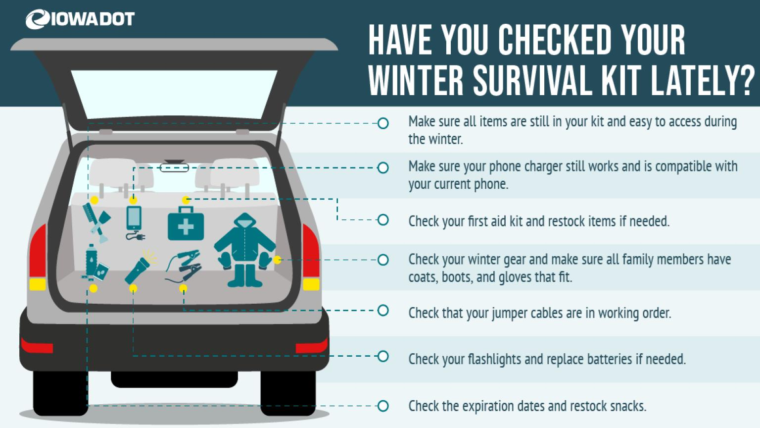
Travel should be restricted to emergencies only. If you must travel, have a winter survival kit with you. If you get stranded, stay with your vehicle.
Avoid outside activities if possible. When outside, make sure you wear appropriate clothing, a hat, and gloves.
Strong and gusty northwest winds will continue to produce significant blowing and drifting of snow across parts of northern Iowa today and tonight. Conditions will be worse in open rural areas while conditions will be much better in sheltered and urban areas. Please travel with caution because it could become a life threatening situation should you become stranded due to the extremely dangerous wind chills.
The strong northwest winds with gusts in the 40 to 50 mph range, will persist today and into this evening before slowly diminishing into Saturday. The wind will continue to create areas of signifcant blowing and drifting of snow and blizzard like conditions over parts of central and northern Iowa. Wind chill values of 35 to 45 below this morning will improve to 20 to 35 below by this afternoon. These temperatures could be life threatening should you become stranded and this makes travel very hazardous due to poor travel conditions.