⚠❄WINTER STORM WARNING in effect for heavy snow⚠❄
….Moderate to Heavy Snow along with Mixed Precipitation Wednesday morning through Thursday Morning…
.A wintry mix of snow, sleet, and freezing rain will spread northward across much of southern and central Iowa by Wednesday afternoon, becoming all snow across northern Iowa.
Snowfall rates may peak at 1 to 2 inches per hour at times during the late afternoon and evening hours Wednesday, mainly across central and northern Iowa. Storm total snow amounts of 5 to 9 inches are likely in Winter Storm Warning, with lesser amounts along and south of Interstate 80.
A light glazing of ice is also possible. Some minor blowing snow may occur with wind gusts in the 20 to 25 mph range but it is not expected to be a significant impact with this event. The snow will gradually end from southwest to northeast on Thursday.

…WINTER STORM WARNING FROM 3 PM WEDNESDAY UNTIL 9 AM THURSDAY FOR CERRO GORDO, WORTH, WINNEBAGO, HANCOCK, WRIGHT, KOSSUTH, FRANKLIN AND BUTLER COUNTIES…
Moderate to heavy snow. Total snow accumulations of 5 to 9 inches.
…WINTER STORM WATCH FROM WEDNESDAY EVENING THROUGH THURSDAY AFTERNOON FOR FLOYD, MITCHELL AND MOWER MN…
Heavy snow is possible. Total snow accumulations of 4 to 8 inches possible.
…WINTER STORM WATCH FROM WEDNESDAY EVENING THROUGH THURSDAY AFTERNOON FOR FREEBORN AND FARIBAULT COUNTIES IN SOUTHERN MINNESOTA…
Heavy snow is possible. Total snow accumulations of 5 to 8 inches possible.
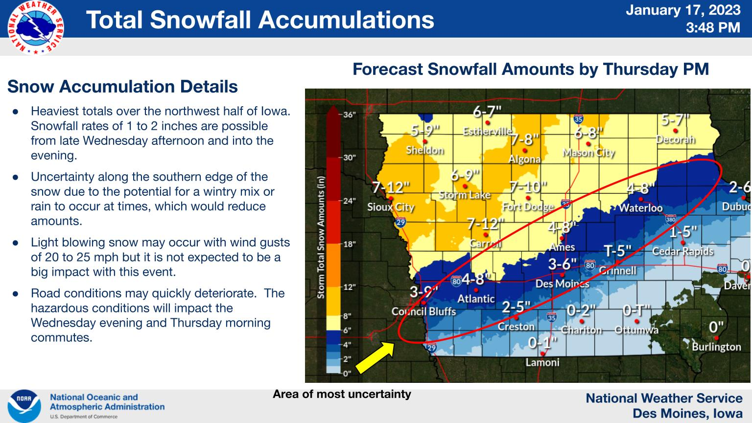
A winter storm will impact much of Iowa Wednesday through Thursday morning. A band of moderate to heavy snowfall is possible over parts of central and northern Iowa. More uncertainty exists on the southern fringe of the snow where a wintry mix or rain. Even small adjustments to forecast temperatures and storm track could have large impacts on the southern edges. The snow will have the greatest snowfall rates from late Wednesday afternoon and into the evening.
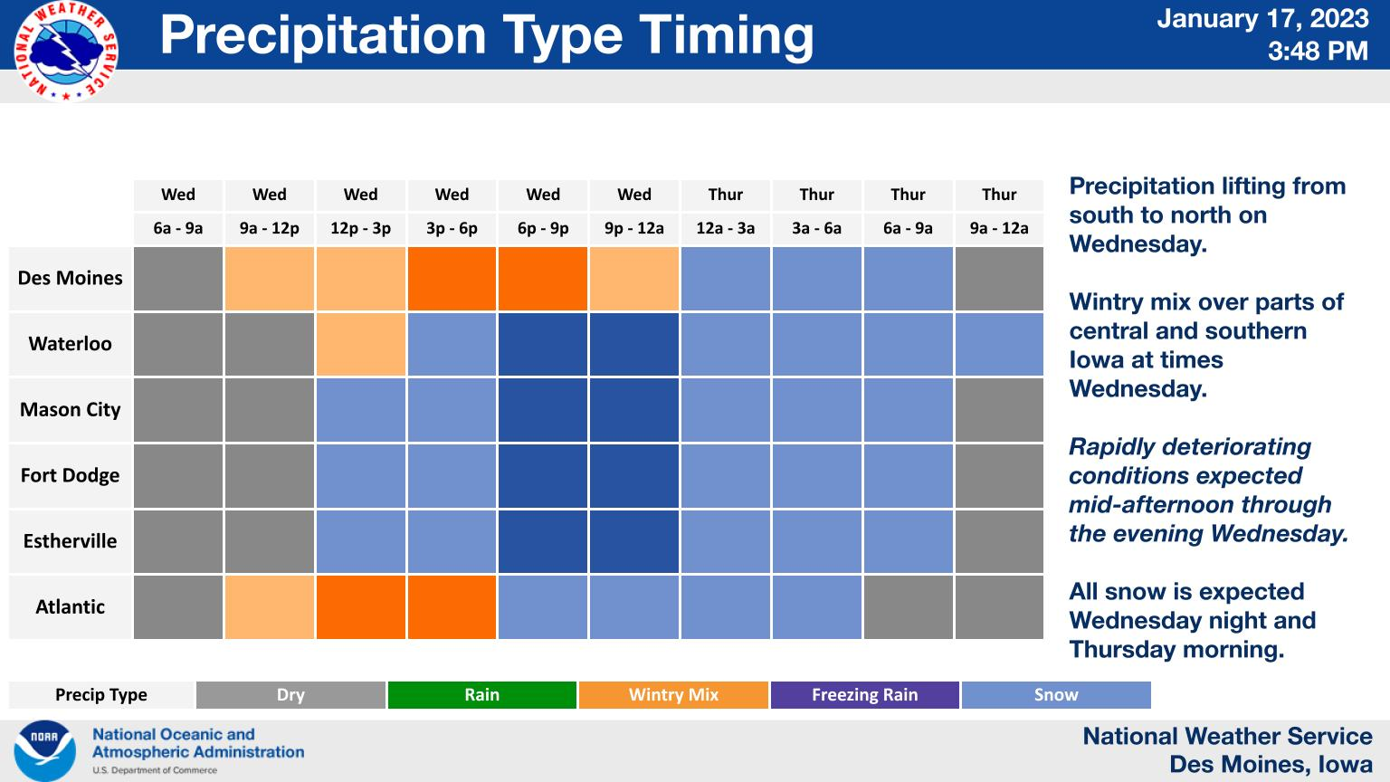
Wintry precipitation will begin to move into Iowa early to mid morning, continuing to spread northward throughout the day. Heaviest precipitation will be seen mid afternoon into the evening, including the potential for some very heavy snowfall rates at times. Be sure to use caution and try to plan accordingly if out traveling.